
IMAGES TAKEN NEAR TO
Balcurvie Road, GLASGOW, G34 9QL
Introduction
This page details the photographs taken nearby to Balcurvie Road, G34 9QL by members of the Geograph project.
The Geograph project started in 2005 with the aim of publishing, organising and preserving representative images for every square kilometre of Great Britain, Ireland and the Isle of Man.

There are currently over 7.5m images from over14,400 individuals and you can help contribute to the project by visiting https://www.geograph.org.uk
Image Map
Images are licensed for reuse under creativecommons.org/licenses/by-sa/2.0
Notes
- Clicking on the map will re-center to the selected point.
- The higher the marker number, the further away the image location is from the centre of the postcode.
Image Listing (13 Images Found)
Images are licensed for reuse under creativecommons.org/licenses/by-sa/2.0
Image
Details
Distance
1
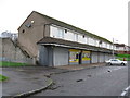
Row of Shops, Conisborough Road, Garthamlock
Only the licensed grocer now open for business.
Image: © G Laird
Taken: 29 Oct 2011
0.09 miles
2
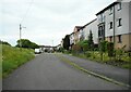
Balcurvie Road
Residential street.
Image: © Richard Sutcliffe
Taken: 1 Jun 2023
0.12 miles
3
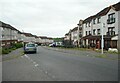
Conisborough Road
From the junction with Balcurvie Road.
Image: © Richard Sutcliffe
Taken: 1 Jun 2023
0.15 miles
4
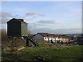
Dovecot at Provanhall
Looking down Balcurvie Road
Image: © Chris Upson
Taken: 17 Feb 2006
0.17 miles
5
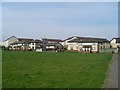
Provanhall housing
Estate near the Provan Hall of Glasgow, after which it gets its name.
Image: © Stephen Sweeney
Taken: 20 Apr 2009
0.19 miles
6
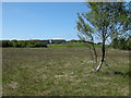
Craigend Moss
A small remnant raised bog, that has dried out.
The site is designated as a Site of Interest for Nature Conservation by Glasgow City Council.
Image: © Richard Sutcliffe
Taken: 29 May 2009
0.19 miles
7
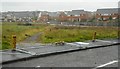
Vacant ground beside Brunstane Road
The area is fenced off, presumably prior to some kind of development. Some of the fencing is currently lying flat, and the desire line across the space is still in use.
Image: © Richard Sutcliffe
Taken: 12 Aug 2018
0.20 miles
8
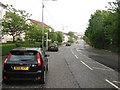
Auchinlea Road
The road is residential on one side with Auchinlea Park on the west side. Taken during a hailstorm.
Image: © Richard Webb
Taken: 16 Jun 2011
0.22 miles
9
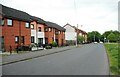
Conisborough Road
Looking towards Auchinlea Road.
Image: © Richard Sutcliffe
Taken: 1 Jun 2023
0.24 miles
10
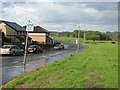
Conisborough Road
Loop road around a housing estate.
Image: © Richard Webb
Taken: 16 Jun 2011
0.24 miles