IMAGES TAKEN NEAR TO
Inverlochy Crescent, GLASGOW, G33 5ES
Introduction
This page details the photographs taken nearby to Inverlochy Crescent, G33 5ES by members of the Geograph project.
The Geograph project started in 2005 with the aim of publishing, organising and preserving representative images for every square kilometre of Great Britain, Ireland and the Isle of Man.

There are currently over 7.5m images from over14,400 individuals and you can help contribute to the project by visiting https://www.geograph.org.uk
Image Map (8 Images)


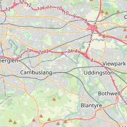
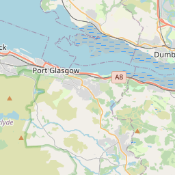

Leaflet Map data © OpenStreetMap
Images are licensed for reuse under creativecommons.org/licenses/by-sa/2.0
Notes
- Clicking on the map will re-center to the selected point.
- The higher the marker number, the further away the image location is from the centre of the postcode.
Image Listing (8 Images Found)
Images are licensed for reuse under creativecommons.org/licenses/by-sa/2.0
Image
Details
Distance
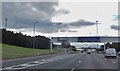
1
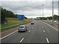
M8 at Garthamlock
Approaching J11. According to the sign, 14 minutes to Glasgow Airport [Saturday afternoon].
Image: © M J Richardson
Taken: 24 Aug 2013
0.16 miles
2
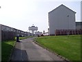
Craigend Water Towers from Riggside Road
Image: © Stephen Sweeney
Taken: 20 Apr 2009
0.20 miles
3
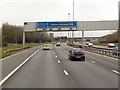
M8, Approaching Junction 10
The typical “Glasgow-type” sign gantry before junction 10 on the M8 motorway with the following distinctive elements:
• Near and offside support legs (basically 2 rectangular hollow sections with base plates to allow connections to the foundations)
• A Main Frame (made up of rectangular hollow sections) - Over clad on the front and rear.
• A Sub Frame (made up of smaller hollow sections and welded to main frame).
• A Sign Face - acrylic sheets hung from the front of the sub frame over its full height.
• Internal Electrics - sign lighting provided through the use of several dozen fluorescent battens.
Gantries of this type were erected as part of the construction of the Kingston Bridge and its approach roads in 1970 and they are now a familiar sight on the network around Glasgow.
More information on “Glasgow Style Gantries” at http://www.glasgows-motorways.co.uk/glasgow-gantries/4578281645 (Glasgow’s Motorways)
Image: © David Dixon
Taken: 20 Apr 2012
0.22 miles
5
The M8 at junction 11
The B765 goes to Queenslie and northward to Stepps.
Image: © Barbara Carr
Taken: 4 Oct 2013
0.22 miles
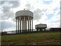
6
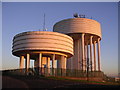
Craigend and Garthamlock Water Towers
Prominent water towers visible from the M8, here caught in late afternoon sunshine
Image: © Chris Upson
Taken: 18 Nov 2005
0.23 miles
7
Water towers, Garthamlock
Viewed from close to the M8 Motorway.
Image: © Richard Sutcliffe
Taken: 5 May 2006
0.23 miles
8
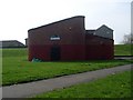
Garthamlock Recreation Centre
Located at the football pitches on Tillycairn Road.
Image: © Stephen Sweeney
Taken: 20 Apr 2009
0.24 miles