IMAGES TAKEN NEAR TO
Silverburn Street, GLASGOW, G33 2LH
Introduction
This page details the photographs taken nearby to Silverburn Street, G33 2LH by members of the Geograph project.
The Geograph project started in 2005 with the aim of publishing, organising and preserving representative images for every square kilometre of Great Britain, Ireland and the Isle of Man.

There are currently over 7.5m images from over14,400 individuals and you can help contribute to the project by visiting https://www.geograph.org.uk
Image Map
Images are licensed for reuse under creativecommons.org/licenses/by-sa/2.0
Notes
- Clicking on the map will re-center to the selected point.
- The higher the marker number, the further away the image location is from the centre of the postcode.
Image Listing (14 Images Found)
Images are licensed for reuse under creativecommons.org/licenses/by-sa/2.0
Image
Details
Distance
3
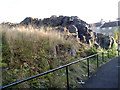
Limestone outcrop
Outcrop of carboniferous limestone between Riddrie Knowes and Gogar Street.
Image: © Rosalind Mitchell
Taken: 22 Oct 2015
0.17 miles
5
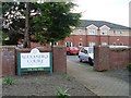
Alexandra Court
Care home on Edinburgh Road.
Image: © Stephen Sweeney
Taken: 21 Apr 2009
0.19 miles
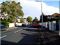
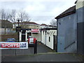
7
Edinburgh Road Surgery
And up the hill, Glasgow's Barlinnie Prison.
Image: © Stephen Sweeney
Taken: 21 Apr 2009
0.20 miles
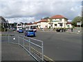
9
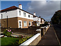
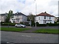
Riddrie Knowes
More typical housing further east on Riddrie Knowes.
Image: © Rosalind Mitchell
Taken: 22 Oct 2015
0.21 miles
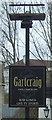
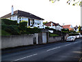
10
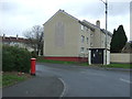
Gartcraig Road
Showing position of Postbox No. G33 1038.
See Image] for postbox.
Image: © JThomas
Taken: 30 Mar 2017
0.22 miles