
IMAGES TAKEN NEAR TO
Glengavel Crescent, GLASGOW, G33 1HJ
Introduction
This page details the photographs taken nearby to Glengavel Crescent, G33 1HJ by members of the Geograph project.
The Geograph project started in 2005 with the aim of publishing, organising and preserving representative images for every square kilometre of Great Britain, Ireland and the Isle of Man.

There are currently over 7.5m images from over14,400 individuals and you can help contribute to the project by visiting https://www.geograph.org.uk
Image Map
Images are licensed for reuse under creativecommons.org/licenses/by-sa/2.0
Notes
- Clicking on the map will re-center to the selected point.
- The higher the marker number, the further away the image location is from the centre of the postcode.
Image Listing (5 Images Found)
Images are licensed for reuse under creativecommons.org/licenses/by-sa/2.0
Image
Details
Distance
1
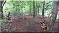
Woodland, Robroyston
A useful bit of singletrack linking Robroyston's new houses and Auchinleck Road. The woods surrounded a hospital, the site of which is now a housing estate.
Image: © Richard Webb
Taken: 9 May 2012
0.14 miles
2
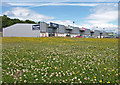
Glasgow North Retail Park, Robroyston
Clover and buttercup covered grass beside the retail park.
Image: © wfmillar
Taken: 20 Jun 2009
0.17 miles
3
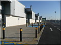
New retail units, Robroyston
Newly developed land to the west of the Asda store in Image Homebase is at the far end.
Image: © Jonathan Billinger
Taken: 12 Feb 2008
0.18 miles
4
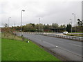
Roundabout at Junction 2, M80
The M80 can be seen crossing the bridge in the background.
Image: © G Laird
Taken: 13 Nov 2010
0.18 miles
5
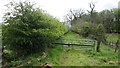
Auchinleck Road
The road is a drive in its northern part and disused to the south. Went on the bike though.
Image: © Richard Webb
Taken: 9 May 2012
0.24 miles