IMAGES TAKEN NEAR TO
Auchenbothie Place, GLASGOW, G33 1GH
Introduction
This page details the photographs taken nearby to Auchenbothie Place, G33 1GH by members of the Geograph project.
The Geograph project started in 2005 with the aim of publishing, organising and preserving representative images for every square kilometre of Great Britain, Ireland and the Isle of Man.

There are currently over 7.5m images from over14,400 individuals and you can help contribute to the project by visiting https://www.geograph.org.uk
Image Map
Images are licensed for reuse under creativecommons.org/licenses/by-sa/2.0
Notes
- Clicking on the map will re-center to the selected point.
- The higher the marker number, the further away the image location is from the centre of the postcode.
Image Listing (22 Images Found)
Images are licensed for reuse under creativecommons.org/licenses/by-sa/2.0
Image
Details
Distance
1
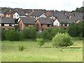
Auchenbothie Crescent
Looking out of Robroyston Park to some recently built houses.
Image: © Richard Webb
Taken: 16 Jun 2011
0.04 miles
3
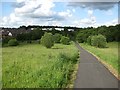
Robroyston Park
Path leaving the park which is mostly rough ground and is pretty accurately described as a nature reserve.
Image: © Richard Webb
Taken: 16 Jun 2011
0.10 miles
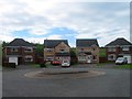
4
Louden Hill Road
A residential street.
Image: © Richard Sutcliffe
Taken: 16 Jul 2021
0.11 miles
5
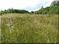
Cleg country
The eastern-most tip of Robroyston Park. A nice meadow habitat, alive with insects. Unfortunately these included lots of clegs, Haematopota pluvialis (biting horseflies)!
The park is owned and managed by Glasgow City Council. Much of the Park was designated as a Local Nature Reserve (LNR) in 2006, and more recently the whole park has been designated as an LNR.
Image: © Richard Sutcliffe
Taken: 16 Jul 2021
0.13 miles
6
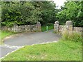
Entrance to Robroyston Park
One of several entrances to the park.
The park is owned and managed by Glasgow City Council. Much of the Park was designated as a Local Nature Reserve (LNR) in 2006, and more recently the whole park has been designated as an LNR.
Image: © Richard Sutcliffe
Taken: 16 Jul 2021
0.14 miles
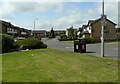
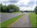
7
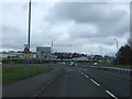
Robroyston Road (B765) approaching roundabout
Heading north east.
Image: © JThomas
Taken: 30 Mar 2017
0.16 miles
9
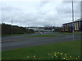
Approaching a roundabout on the B765
Traffic queueing to join the roundabout.
Image: © Richard Sutcliffe
Taken: 16 Jul 2021
0.16 miles
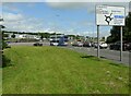
10
Sign on approach to roundabout at Robroyston
Image: © Stephen Sweeney
Taken: 3 Jun 2009
0.17 miles