IMAGES TAKEN NEAR TO
Birchwood Avenue, GLASGOW, G32 0NT
Introduction
This page details the photographs taken nearby to Birchwood Avenue, G32 0NT by members of the Geograph project.
The Geograph project started in 2005 with the aim of publishing, organising and preserving representative images for every square kilometre of Great Britain, Ireland and the Isle of Man.

There are currently over 7.5m images from over14,400 individuals and you can help contribute to the project by visiting https://www.geograph.org.uk
Image Map
Images are licensed for reuse under creativecommons.org/licenses/by-sa/2.0
Notes
- Clicking on the map will re-center to the selected point.
- The higher the marker number, the further away the image location is from the centre of the postcode.
Image Listing (15 Images Found)
Images are licensed for reuse under creativecommons.org/licenses/by-sa/2.0
Image
Details
Distance
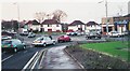
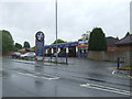
1
Carrick Drive
Looking south from Baillieston Road.
Image: © JThomas
Taken: 29 Jun 2017
0.11 miles
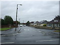
4
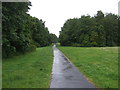
Path towards Garrowhill
Off Baillieston Road.
Image: © JThomas
Taken: 29 Jun 2017
0.15 miles
5
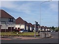
Barrachnie, Church Army houses
Juniper Terrace, built after the First World War.
Image: © Robert Murray
Taken: 10 Jun 2005
0.16 miles
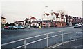
7
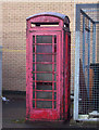
Barrachnie, A forlorn and forgotten phone box
Hidden behind a row of shops at Barrachnie.
Image: © Robert Murray
Taken: 20 Mar 2004
0.16 miles
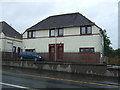
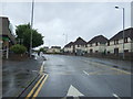
8
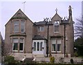
Fire-Damaged House, Mount Vernon
On Bowling Green Road
Image: © Chris Upson
Taken: 10 Mar 2006
0.20 miles