IMAGES TAKEN NEAR TO
Corsock Street, GLASGOW, G31 3RZ
Introduction
This page details the photographs taken nearby to Corsock Street, G31 3RZ by members of the Geograph project.
The Geograph project started in 2005 with the aim of publishing, organising and preserving representative images for every square kilometre of Great Britain, Ireland and the Isle of Man.

There are currently over 7.5m images from over14,400 individuals and you can help contribute to the project by visiting https://www.geograph.org.uk
Image Map
Images are licensed for reuse under creativecommons.org/licenses/by-sa/2.0
Notes
- Clicking on the map will re-center to the selected point.
- The higher the marker number, the further away the image location is from the centre of the postcode.
Image Listing (24 Images Found)
Images are licensed for reuse under creativecommons.org/licenses/by-sa/2.0
Image
Details
Distance
1
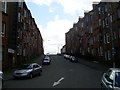
Aberfoyle Street
Very traditional Glasgow housing on this East End street.
Image: © Stephen Sweeney
Taken: 21 Apr 2009
0.11 miles
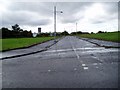
2
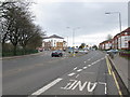
Junction of A8 and A80
Looking east along Cumbernauld Road (A8) to the junction where Cumbernauld Road continues to the left as the A80 while the A8 continues straight through as Edinburgh Road.
In the days before the M8 bypassed this junction, for most of the day this was extremely congested often taking a long time to travel along Alexandra Parade and Cumbernauld Road to this junction.
Image: © G Laird
Taken: 28 Mar 2009
0.11 miles
3
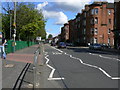
Cumbernauld Road, Dennistoun
View of Cumbernauld Road from entrance to Haghill Community Centre looking east. Dennistoun is a large district in the city of Glasgow. It is situated north of the River Clyde in the east end of the city.
Image: © George Rankin
Taken: 20 May 2007
0.13 miles
4
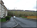
Bengairn Street at Todd Street Haghill Glasgow
Once a Glasgow City Council housing scheme of flats the area has been cleared for several years. Some development has taken place further North on Todd Street with new low rise houses built. 12th August 2009
Image: © Gordon Dowie
Taken: 12 Aug 2009
0.13 miles
5
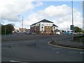
Cumbernauld Road at Edinburgh Road
Major road junction in the East End of Glasgow.
Image: © Stephen Sweeney
Taken: 21 Apr 2009
0.14 miles
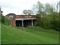
6
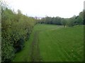
Dismantled railway route, Haghill
From Edinburgh Road.
Image: © Stephen Sweeney
Taken: 21 Apr 2009
0.16 miles
7
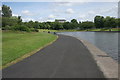
The pond, Alexandra Park
The far end of the pond has had the edges 'naturalised', making it more attractive for wildlife.
Image: © Richard Sutcliffe
Taken: 7 Jul 2016
0.16 miles
8
Edinburgh Road crosses dismantled railway
Between Haghill and Carntyne.
Image: © Stephen Sweeney
Taken: 21 Apr 2009
0.18 miles
9
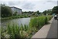
The pond, Alexandra Park
This end of the pond has had the edges 'naturalised', making it more attractive for wildlife. The building on the left is part of Haghill Park Primary School.
Image: © Richard Sutcliffe
Taken: 7 Jul 2016
0.19 miles