IMAGES TAKEN NEAR TO
Alexandra Parade, GLASGOW, G31 2ER
Introduction
This page details the photographs taken nearby to Alexandra Parade, G31 2ER by members of the Geograph project.
The Geograph project started in 2005 with the aim of publishing, organising and preserving representative images for every square kilometre of Great Britain, Ireland and the Isle of Man.

There are currently over 7.5m images from over14,400 individuals and you can help contribute to the project by visiting https://www.geograph.org.uk
Image Map
Images are licensed for reuse under creativecommons.org/licenses/by-sa/2.0
Notes
- Clicking on the map will re-center to the selected point.
- The higher the marker number, the further away the image location is from the centre of the postcode.
Image Listing (387 Images Found)
Images are licensed for reuse under creativecommons.org/licenses/by-sa/2.0
Image
Details
Distance
1
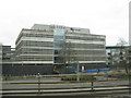
Glasgow Royal Infirmary
Viewed from the north,
Image: © M J Richardson
Taken: 4 May 2016
0.03 miles
2
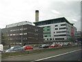
Glasgow Royal Infirmary
Viewed from the M8 en route to Glasgow Airport.
Image: © M J Richardson
Taken: 4 May 2016
0.05 miles
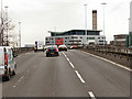
4
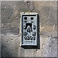
Flush Bracket, Glasgow
Flush bracket on the eastern side of Glasgow Royal Infirmary at Glenfield Street. Access is via Glenfield Street (what appears to be a staff or delivery entrance to the hospital) and the bracket is easily located (see Image).
The number on the bracket is OSBM G208.
The mark is 34.7073 metres above MSL (Newlyn datum).
Further information available at the Bench Mark Database http://www.bench-marks.org.uk/bm16798 .
Image: © Rossographer
Taken: 27 Apr 2013
0.07 miles
5
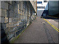
Flush Bracket, Glasgow
Flush bracket on the eastern side of Glasgow Royal Infirmary at Glenfield Street. Access is via Glenfield Street (what appears to be a staff or delivery entrance to the hospital) and the bracket is easily located - it is visible in the bottom left of this picture or see Image for a close-up.
The number on the bracket is OSBM G208.
The mark is 34.7073 metres above MSL (Newlyn datum).
Further information available at the Bench Mark Database http://www.bench-marks.org.uk/bm16798 .
Image: © Rossographer
Taken: 27 Apr 2013
0.07 miles
6
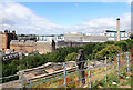
Glasgow Royal Infirmary seen from Glasgow Necropolis
Image: © habiloid
Taken: 29 Jul 2021
0.07 miles
7
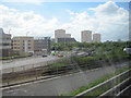
M8 junction 15 looking south
The road on the left is Castle Street. From westbound M8
Image: © John Firth
Taken: 9 May 2011
0.08 miles
8
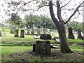
Necropolis Glasgow
One of the many stones in the Glasgow Necropolis
Image: © Mat Tuck
Taken: 19 Aug 2013
0.09 miles
9
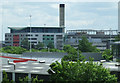
Glasgow Royal Infirmary
Viewed from the motorway footbridge at North Wallace Street.
Image: © Thomas Nugent
Taken: 5 Jun 2012
0.09 miles