IMAGES TAKEN NEAR TO
Earlston Place, GLASGOW, G21 2LB
Introduction
This page details the photographs taken nearby to Earlston Place, G21 2LB by members of the Geograph project.
The Geograph project started in 2005 with the aim of publishing, organising and preserving representative images for every square kilometre of Great Britain, Ireland and the Isle of Man.

There are currently over 7.5m images from over14,400 individuals and you can help contribute to the project by visiting https://www.geograph.org.uk
Image Map
Images are licensed for reuse under creativecommons.org/licenses/by-sa/2.0
Notes
- Clicking on the map will re-center to the selected point.
- The higher the marker number, the further away the image location is from the centre of the postcode.
Image Listing (66 Images Found)
Images are licensed for reuse under creativecommons.org/licenses/by-sa/2.0
Image
Details
Distance
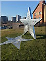
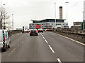
1
The Roystonhill Star
Viewed from the M8 motorway.
See Image for information about the star.
Image: © Thomas Nugent
Taken: 23 Feb 2020
0.04 miles
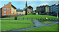
2
Roystonhill "STAR" sculpture
Commissioned and placed by Spire View Housing Association in 2012, the shadow is etched with drawings of 'yesteryear' made by local senior citizens, and aspirational statements by the children of nearby Royston Primary and St Roch's Primary schools.
Image: © Craig Wallace
Taken: 5 Apr 2013
0.05 miles
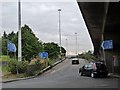
3
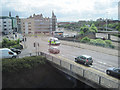
M8 slipway
Leads from Castle Street to the eastbound flow of the M8.
Image: © Stephen Sweeney
Taken: 19 Jun 2008
0.09 miles
4
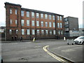
St Roch's Secondary School
On Royston Road.
Image: © Richard Sutcliffe
Taken: 23 Aug 2019
0.10 miles
7
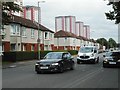
Royston Road
The tower blocks in the distance are on Charles Street.
Image: © Richard Sutcliffe
Taken: 23 Aug 2019
0.11 miles
8
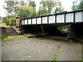
Pedestrian underpass
Now an underpass under the A803, Castle Street, this was originally a link between the Forth and Clyde and Monkland canals. A small section of the towpath survives. See Canmore https://canmore.org.uk/site/296804/glasgow-castle-street-bridge-underpass. The bridge once carried a tramway over the canal.
Image: © Richard Sutcliffe
Taken: 23 Aug 2019
0.12 miles
9
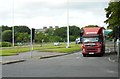
Road junction
A lorry waits at traffic lights about to turn onto Royston Road.
Image: © Richard Sutcliffe
Taken: 23 Aug 2019
0.12 miles