
IMAGES TAKEN NEAR TO
Maryhill Road, GLASGOW, G20 7TL
Introduction
This page details the photographs taken nearby to Maryhill Road, G20 7TL by members of the Geograph project.
The Geograph project started in 2005 with the aim of publishing, organising and preserving representative images for every square kilometre of Great Britain, Ireland and the Isle of Man.

There are currently over 7.5m images from over14,400 individuals and you can help contribute to the project by visiting https://www.geograph.org.uk
Image Map
Images are licensed for reuse under creativecommons.org/licenses/by-sa/2.0
Notes
- Clicking on the map will re-center to the selected point.
- The higher the marker number, the further away the image location is from the centre of the postcode.
Image Listing (63 Images Found)
Images are licensed for reuse under creativecommons.org/licenses/by-sa/2.0
Image
Details
Distance
2
Maryhill Fire Station
The fire station is on Maryhill Road, and is viewed here from the canal towpath.
Image: © Anne Burgess
Taken: 25 Jun 2019
0.00 miles
3
Maryhill Fire Station
With platform truck outside.
Image: © Richard Sutcliffe
Taken: 6 Aug 2024
0.01 miles
4
Platform truck
A fireman wipes down the platform of a platform truck outside Maryhill Fire Station.
Image: © Richard Sutcliffe
Taken: 6 Aug 2024
0.02 miles
5
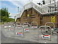
Maryhill Road cycle parking
The cycle racks are at the foot of the steps up to a bridge over the canal Image that leads to a student village, so students are obviously intended to leave their bikes here and walk over the bridge. Despite the CCTV warnings it doesn't look a secure location, and I expect many will carry their bikes up the steps and keep them in their flats.
Image: © Stephen Craven
Taken: 25 Jun 2019
0.03 miles
6
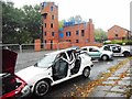
Training area, Maryhill Fire Station
The cars appear to have been used for training firemen how to cut people out of cars after road traffic accidents.
Image: © Richard Sutcliffe
Taken: 3 Sep 2017
0.04 miles
7
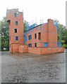
Training area, Maryhill Fire Station
Image: © Richard Sutcliffe
Taken: 3 Sep 2017
0.04 miles
8
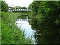
Footbridge over the Forth and Clyde Canal
Image: © Philip Halling
Taken: 25 Jun 2019
0.04 miles
9
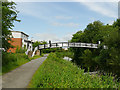
Footbridge from Maryhill Road
The main purpose for this bridge would seem to be to allow residents of the 'student village' on the far side of the canal to access shops and buses on Maryhill Road on this side.
Image: © Stephen Craven
Taken: 25 Jun 2019
0.04 miles
10
![Forth and Clyde Canal [21]](https://s0.geograph.org.uk/geophotos/06/24/84/6248400_ddfab0be_120x120.jpg)
Forth and Clyde Canal [21]
Maryhill Road footbridge links Maryhill Road to Caithness Street.
The Forth and Clyde Canal was completed in 1790 and it provided a route for vessels between the Firth of Forth and the Firth of Clyde at the narrowest part (35 miles, 56km) of the Scottish Lowlands. Closed in 1963, the canal became semi-derelict. Millennium funds were used to regenerate the canal. The Glasgow Branch of the canal is a Scheduled Monument with details at: http://portal.historicenvironment.scot/designation/SM6771
Image: © Michael Dibb
Taken: 25 Jun 2019
0.04 miles