
IMAGES TAKEN NEAR TO
Wilton Street, GLASGOW, G20 6LF
Introduction
This page details the photographs taken nearby to Wilton Street, G20 6LF by members of the Geograph project.
The Geograph project started in 2005 with the aim of publishing, organising and preserving representative images for every square kilometre of Great Britain, Ireland and the Isle of Man.

There are currently over 7.5m images from over14,400 individuals and you can help contribute to the project by visiting https://www.geograph.org.uk
Image Map
Images are licensed for reuse under creativecommons.org/licenses/by-sa/2.0
Notes
- Clicking on the map will re-center to the selected point.
- The higher the marker number, the further away the image location is from the centre of the postcode.
Image Listing (160 Images Found)
Images are licensed for reuse under creativecommons.org/licenses/by-sa/2.0
Image
Details
Distance
1
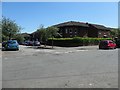
Housing at the junction of Kirkland and Wilton Streets, Glasgow
Part of a small estate bisected by Simpson Street.
Image: © Christine Johnstone
Taken: 26 Jun 2019
0.04 miles
3
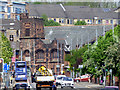
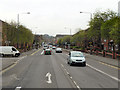
Maryhill Road
Looking towards Queens Cross and the Category A Listed 'Mackintosh Church' http://portal.historicenvironment.scot/designation/LB33764 .
Image: © Thomas Nugent
Taken: 17 May 2019
0.05 miles
4
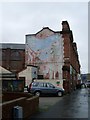
Building the Community
Mural on Maryhill Road.
Image: © Stephen Sweeney
Taken: 20 Jan 2009
0.05 miles
5
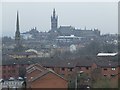
West End vista
Viewed from the Forth and Clyde canal at Firhill. Glasgow University tower on Gilmorehill is prominent in the centre.
Image: © Thomas Nugent
Taken: 13 Feb 2009
0.06 miles
6
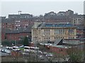
Hinshaw Street
The coaches are parked on Hinshaw Street, near the former Springbank Public School which is prominent in the photo.
Image: © Thomas Nugent
Taken: 13 Feb 2009
0.10 miles
7
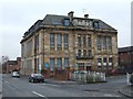
Former Springbank Public School
On Doncaster Street, now appears to be a Social Work office.
Image: © Thomas Nugent
Taken: 13 Feb 2009
0.10 miles
8
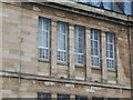
Former Springbank Public School
Detail on the Doncaster Street side of the building. See also Image
Image: © Thomas Nugent
Taken: 13 Feb 2009
0.10 miles
9
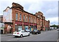
Maryhill Community Central Hall
On Maryhill Road. Originally built as Methodist halls, probably by Watson and Salmond, around 1920. It comprises community halls and shops and is Category C listed https://portal.historicenvironment.scot/designation/LB33774/.
Image: © Richard Sutcliffe
Taken: 22 Jul 2024
0.11 miles
10
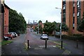
Trossachs Street
The spire of St Mary's Scottish Episcopal Cathedral on Great Western Road and Glasgow University tower can be seen in the distance.
Image: © Richard Sutcliffe
Taken: 22 Jul 2024
0.11 miles