IMAGES TAKEN NEAR TO
Millhouse Crescent, GLASGOW, G20 0UD
Introduction
This page details the photographs taken nearby to Millhouse Crescent, G20 0UD by members of the Geograph project.
The Geograph project started in 2005 with the aim of publishing, organising and preserving representative images for every square kilometre of Great Britain, Ireland and the Isle of Man.

There are currently over 7.5m images from over14,400 individuals and you can help contribute to the project by visiting https://www.geograph.org.uk
Image Map
Images are licensed for reuse under creativecommons.org/licenses/by-sa/2.0
Notes
- Clicking on the map will re-center to the selected point.
- The higher the marker number, the further away the image location is from the centre of the postcode.
Image Listing (111 Images Found)
Images are licensed for reuse under creativecommons.org/licenses/by-sa/2.0
Image
Details
Distance
1
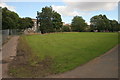
Amenity grassland, Maryhill
Looking from the Kelvin Walkway across amenity grassland towards where new houses are being built (behind the trees).
Image: © Richard Sutcliffe
Taken: 8 Jul 2016
0.04 miles
2

The Kelvin Walkway
It is also a cycle path. The cyclist has just passed under the Kelvin Viaduct, built about 1858 for the Glasgow, Dumbarton and Helensburgh Railway and still in use.
Image: © Richard Sutcliffe
Taken: 12 Mar 2025
0.05 miles
3
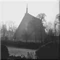
Our Lady of the Immaculate Conception, Maryhill
This church, now replaced, was demolished after structural defects were found in its 'A' frame design.
Image: © Alan Reid
Taken: Unknown
0.06 miles
4
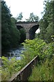
Kelvin Viaduct, Maryhill
Built about 1858 for the Glasgow, Dumbarton and Helensburgh Railway. There are seven arches in all, although only two are visible here. Today the viaduct carries the line from Glasgow Queen Street to Anniesland.
A clump of Japanese knotweed is growing beside the River Kelvin.
Image: © Richard Sutcliffe
Taken: 8 Jul 2016
0.07 miles
6

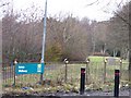
Kelvin Viaduct
Built about 1858 for the Glasgow, Dumbarton and Helensburgh Railway. It carries a double railway line over the River Kelvin.
Image: © Richard Sutcliffe
Taken: 12 Mar 2025
0.07 miles
7

Maryhill Lochgilp St SUD
A SUDs pond close to the Lochgilp Street housing development (completed in 2019). The pond is surrounded by railings and is part of Scottish Water's infrastructure.
Image: © Richard Sutcliffe
Taken: 12 Mar 2025
0.08 miles
8
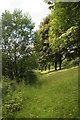
Trees beside the Kelvin
This is a strip of land between the River Kelvin on the left, and the Kelvin Walkway on the right.
Image: © Richard Sutcliffe
Taken: 8 Jul 2016
0.10 miles
9
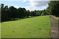
Amenity grassland, Maryhill
The River Kelvin is just beyond the trees on the left.
Image: © Richard Sutcliffe
Taken: 8 Jul 2016
0.11 miles