IMAGES TAKEN NEAR TO
Drumry Road East, GLASGOW, G15 8PT
Introduction
This page details the photographs taken nearby to Drumry Road East, G15 8PT by members of the Geograph project.
The Geograph project started in 2005 with the aim of publishing, organising and preserving representative images for every square kilometre of Great Britain, Ireland and the Isle of Man.

There are currently over 7.5m images from over14,400 individuals and you can help contribute to the project by visiting https://www.geograph.org.uk
Image Map
Images are licensed for reuse under creativecommons.org/licenses/by-sa/2.0
Notes
- Clicking on the map will re-center to the selected point.
- The higher the marker number, the further away the image location is from the centre of the postcode.
Image Listing (97 Images Found)
Images are licensed for reuse under creativecommons.org/licenses/by-sa/2.0
Image
Details
Distance
1
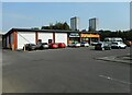
Farmfoods, Drumchapel
A frozen food and grocery supermarket.
Image: © Richard Sutcliffe
Taken: 6 Sep 2023
0.01 miles
2
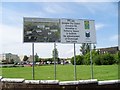
Sign regarding regeneration of Drumchapel
Showing the plans to demolish and rebuild Dunkenny Place in the shopping centre.
Image: © Stephen Sweeney
Taken: 24 Jul 2008
0.01 miles
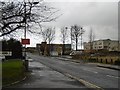
3
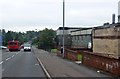
Drumry Road East
At the junction with Duntreath Avenue.
Image: © Richard Webb
Taken: 4 Jan 2016
0.02 miles
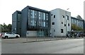
4
The West Centre
Health and Care Centre on Kinfauns Drive, Drumchapel.
Image: © Richard Sutcliffe
Taken: 6 Sep 2023
0.05 miles
5
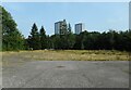
Vacant site
Previously occupied by Glasgow City Council's Social Work Services, Drumry House.
Image: © Richard Sutcliffe
Taken: 6 Sep 2023
0.06 miles
6
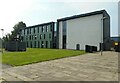
The rear of the West Centre
Health and Care Centre on Kinfauns Drive, Drumchapel.
Image: © Richard Sutcliffe
Taken: 6 Sep 2023
0.06 miles
7
The West Centre
Health and Care Centre on Kinfauns Drive, Drumchapel.
Image: © Richard Sutcliffe
Taken: 6 Sep 2023
0.06 miles
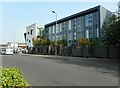
8
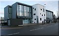
The West Centre, Drumchapel
The West Centre is a purpose built Centre for Children’s Community Health and Care on Kinfauns Drive, which opened in 2010.
Image: © Richard Sutcliffe
Taken: 14 Jan 2017
0.06 miles
9
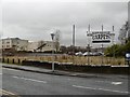
Duntreath Avenue, Drumchapel
Light industrial area shown as farmland on a 1958 map.
Image: © Richard Webb
Taken: 4 Jan 2016
0.06 miles