
IMAGES TAKEN NEAR TO
Foswell Drive, GLASGOW, G15 8JF
Introduction
This page details the photographs taken nearby to Foswell Drive, G15 8JF by members of the Geograph project.
The Geograph project started in 2005 with the aim of publishing, organising and preserving representative images for every square kilometre of Great Britain, Ireland and the Isle of Man.

There are currently over 7.5m images from over14,400 individuals and you can help contribute to the project by visiting https://www.geograph.org.uk
Image Map
Images are licensed for reuse under creativecommons.org/licenses/by-sa/2.0
Notes
- Clicking on the map will re-center to the selected point.
- The higher the marker number, the further away the image location is from the centre of the postcode.
Image Listing (43 Images Found)
Images are licensed for reuse under creativecommons.org/licenses/by-sa/2.0
Image
Details
Distance
1
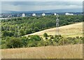
Woodland north of Drumchapel
Seen from Castle Hill.
Image: © Richard Sutcliffe
Taken: 8 Aug 2021
0.04 miles
2
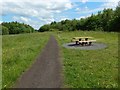
Path in Garscadden Wood
The same area is shown, from the other end, in Image
The path is, at the time of writing, shown on large-scale OS mapping, but it has the appearance of having been upgraded since then, and perhaps redirected slightly.
Image: © Lairich Rig
Taken: 3 Jul 2015
0.08 miles
3
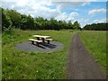
Path in Garscadden Wood
This is the main path through this part of the woodland. At the time of writing, it is shown on large-scale OS mapping, but it has the appearance of having been upgraded more recently.
See also Image, a view of the same area, but from the other end, looking back.
Image: © Lairich Rig
Taken: 3 Jul 2015
0.08 miles
4
Public art, Drumchapel, Glasgow
Installed in 2009, this sculpture of Pegasus is by Andy Scott who is probably more famous for Image
Image: © Claire Pegrum
Taken: 22 May 2023
0.09 miles
5
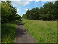
Path through Garscadden Wood
The view is from not far beyond the wide clearing shown in Image The path is shown on large-scale OS mapping.
Image: © Lairich Rig
Taken: 3 Jul 2015
0.11 miles
6
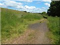
Track beside Hutcheson Hill
This part of the track may correspond to the line of the Military Way, which was built in connection with the Antonine Wall. The Military Way was a road that, for the entire length of the Wall, ran a short distance to the south of the Wall's rampart.
The first-edition OS map (surveyed in 1861) goes as far as to label a section of this track, including the part shown in this picture, "site of the Military Way". Later editions (until the Second World War, if not later) do likewise.
The slopes of Hutcheson Hill are on the left; the ditch of the Antonine Wall can be followed over that hill (see Image and related images).
This track, at the foot of the slopes of Hutcheson Hill, does appear to be in at least the right general area for the Military Way; the antiquarian Alexander Gordon, in his 1727 work "Itinerarium Septentrionale", discusses its course here (referring to it as "the Causeway"):
"From the above-mentioned Rivulet called the Cladden Burn, I observed the Causeway takes a Turn considerably Southward from the Ditch, keeping by the Declivity or Foot of Hutcheson Hill, no doubt for the easier marching of the Soldiers who travelled along it."
See Image for more on that subject.
Image: © Lairich Rig
Taken: 3 Jul 2015
0.14 miles
7
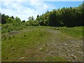
Path through wooded area
The 1:25000 shows a network of paths, including the one shown here, through this wooded area.
Image: © Lairich Rig
Taken: 12 Jun 2015
0.15 miles
9
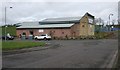
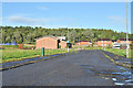
The Church on the Hill
Drumchapel's Baptist church on Lillyburn Place, which was built in 1965-66.
Image: © Richard Sutcliffe
Taken: 14 Apr 2017
0.15 miles
10
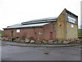
Drumchapel Baptist Church (The Church on the Hill)
The Baptist Church is situated on Lillyburn Place on the edge of Drumchapel. Drumchapel Baptist Church was started by members of Hillhead Baptist Church in 1961 and was added to the Baptist Union in 1962.
Image: © G Laird
Taken: 26 Dec 2013
0.16 miles