
IMAGES TAKEN NEAR TO
Merryton Gardens, GLASGOW, G15 7PE
Introduction
This page details the photographs taken nearby to Merryton Gardens, G15 7PE by members of the Geograph project.
The Geograph project started in 2005 with the aim of publishing, organising and preserving representative images for every square kilometre of Great Britain, Ireland and the Isle of Man.

There are currently over 7.5m images from over14,400 individuals and you can help contribute to the project by visiting https://www.geograph.org.uk
Image Map
Images are licensed for reuse under creativecommons.org/licenses/by-sa/2.0
Notes
- Clicking on the map will re-center to the selected point.
- The higher the marker number, the further away the image location is from the centre of the postcode.
Image Listing (29 Images Found)
Images are licensed for reuse under creativecommons.org/licenses/by-sa/2.0
Image
Details
Distance
1
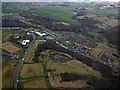
Drumchapel from the air
Lots of brownfield former council housing estate sites on view.
Image: © Thomas Nugent
Taken: 24 Feb 2017
0.10 miles
2
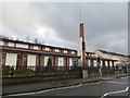
The Kinfauns Centre
A conference centre with interesting architecture.
Image: © Richard Webb
Taken: 19 Jan 2014
0.15 miles
3
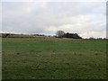
Ryedale Place
Housing scheme, now demolished leaving a big green space with a road network.
Image: © Richard Webb
Taken: 19 Jan 2014
0.16 miles
4

Barnkirk Avenue
Housing built here in the 1950s was demolished many years ago.
Image: © Richard Sutcliffe
Taken: 12 Nov 2025
0.17 miles
5
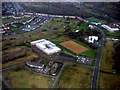
Drumchapel High School from the air
A new building in the middle of a brownfield desert. Here is a http://www.drumchapelhigh.glasgow.sch.uk/ to the school's web site.
Image: © Thomas Nugent
Taken: 3 Nov 2017
0.18 miles
6

Corner of Barnkirk Avenue and Bayfield Terrace
Housing built here in the 1950s was demolished many years ago. The distant tower blocks are on Linkwood Crescent.
Image: © Richard Sutcliffe
Taken: 12 Nov 2025
0.19 miles
7
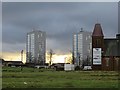
Empty streets, Drumchapel
A large area of former housing and a former church, now demolished off Kinfauns Drive.
Image: © Richard Webb
Taken: 19 Jan 2014
0.19 miles
8

Bayfield Terrace
The former St Pius X Roman Catholic Church is now a Self Storage business.
Image: © Richard Sutcliffe
Taken: 12 Nov 2025
0.20 miles
9

Entrance to former church
The former St Pius X Roman Catholic Church now houses J N Electric's Ltd and Self Storage units.
The church was built 1954-7 (Alexander McAnally, architect) and is Category B listed https://portal.historicenvironment.scot/apex/f?p=1505:300:::::VIEWTYPE,VIEWREF:designation,LB43031. It closed in the early 2000s and the grounds were used to build Crannog Care Home Image The church buildings have since been used by J N Electrics Ltd, Carrie's Dance Company and Nell's Kitchen, before adding self storage.
Image: © Richard Sutcliffe
Taken: 12 Nov 2025
0.20 miles
10
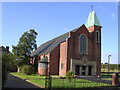
Saint Pius X Church
Roman Catholic church in Drumchapel
Image: © Chris Upson
Taken: 23 Sep 2005
0.20 miles