IMAGES TAKEN NEAR TO
Knightswood Road, GLASGOW, G13 2EY

Introduction

This page details the photographs taken nearby to Knightswood Road, G13 2EY by members of the Geograph project.

The Geograph project started in 2005 with the aim of publishing, organising and preserving representative images for every square kilometre of Great Britain, Ireland and the Isle of Man.

There are currently over 7.5m images from over14,400 individuals and you can help contribute to the project by visiting https://www.geograph.org.uk

Image Map


Images are licensed for reuse under creativecommons.org/licenses/by-sa/2.0
Notes
  • Clicking on the map will re-center to the selected point.
  • The higher the marker number, the further away the image location is from the centre of the postcode.

Image Listing (58 Images Found)

Images are licensed for reuse under creativecommons.org/licenses/by-sa/2.0
  • ...
Image
Details
Distance
1
Knightswood Gifts and post office
On Knightswood Road. The pillarbox is postbox number G13 742.
Image: © Richard Sutcliffe Taken: 26 May 2022
0.07 miles
2
Shops, Knightswood Road
A variety of businesses, including a gift shop, Cantonese and Peking style takeaway and the post office.
Image: © Richard Sutcliffe Taken: 26 May 2022
0.08 miles
3
Knightswood St Margaret's Parish Church
At the junction of Great Western Road and Knightswood Road. http://knightswoodstmargarets.org.uk/
Image: © G Laird Taken: 20 Mar 2010
0.08 miles
4
Church of St Ninian church hall
Category B listed http://portal.historicenvironment.scot/designation/LB43038 together with the adjacent St Ninian's RC Church. Both date from 1956-1959.
Image: © Richard Sutcliffe Taken: 26 May 2022
0.09 miles
5
Baldwin Avenue
Seen from the junction with Cedric Road.
Image: © Richard Sutcliffe Taken: 26 May 2022
0.10 miles
6
St Ninian's Presbytery
Attached to St Ninian's RC Church, facing Baldwin Avenue.
Image: © Richard Sutcliffe Taken: 26 May 2022
0.12 miles
7
St Margaret's Church Hall
The hall dates from 1925.
Image: © Richard Sutcliffe Taken: 26 May 2022
0.12 miles
8
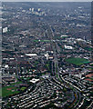
Great Western Road from the air
Knightswood Cross is in the foreground, Anniesland Cross can be seen nearer the centre. The decommissioned Kelvindale gas holders can be seen on the left. Gartnavel Hospitals campus is on the right. Anniesland Court towerblock is near the centre.
Image: © Thomas Nugent Taken: 21 Oct 2013
0.12 miles
9
A82, Great Western Road
Passing through Knightswood, plenty blossom at this time.
Image: © wfmillar Taken: 19 Apr 2011
0.12 miles
10
Knightswood Bowls Club
Image: © Chris Upson Taken: 2 Sep 2005
0.12 miles
  • ...