
IMAGES TAKEN NEAR TO
Sutcliffe Road, GLASGOW, G13 1BU
Introduction
This page details the photographs taken nearby to Sutcliffe Road, G13 1BU by members of the Geograph project.
The Geograph project started in 2005 with the aim of publishing, organising and preserving representative images for every square kilometre of Great Britain, Ireland and the Isle of Man.

There are currently over 7.5m images from over14,400 individuals and you can help contribute to the project by visiting https://www.geograph.org.uk
Image Map
Images are licensed for reuse under creativecommons.org/licenses/by-sa/2.0
Notes
- Clicking on the map will re-center to the selected point.
- The higher the marker number, the further away the image location is from the centre of the postcode.
Image Listing (132 Images Found)
Images are licensed for reuse under creativecommons.org/licenses/by-sa/2.0
Image
Details
Distance
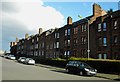
2
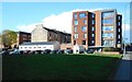
Religious buildings at Anniesland
The low white-coloured building is the Glasgow Vineyard Centre. Originally known as Glasgow Westend Vineyard, Glasgow Vineyard was formed in the West End of Glasgow in May 2000. They have established a ministry base in Anniesland which serves the local community, via a long running food bank and parent and babies group here.
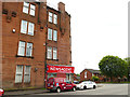
The red brick building on the right is a block of 24 flats for over 55 year olds, with Anniesland Methodist Church on the ground floor. It was built in 2015, replacing the original Methodist Church on the site.
Image: © Richard Sutcliffe
Taken: 27 Apr 2018
0.03 miles
3
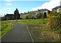
Anniesland Meadow
A small park surrounded by housing just beside Anniesland Cross.
Image: © Richard Sutcliffe
Taken: 27 Apr 2018
0.03 miles
4
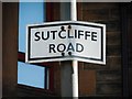
Sutcliffe Road sign
Sign for Sutcliffe Road [http://www.geograph.org.uk/photo/5755448].
Image: © Richard Sutcliffe
Taken: 27 Apr 2018
0.03 miles
5
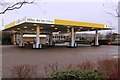
Morrisons Petrol Station in Anniesland Retail Park
Morrisons petrol station in Anniesland situated just off Bearsden Road and is one of the businesses in the retail park serving this area of the city. The entrance to the petrol station is from Crow Road North.
Image: © Garry Cornes
Taken: 25 Dec 2015
0.08 miles
6

Anniesland from the air
Featuring the Category A Listed https://portal.historicenvironment.scot/apex/f?p=1505:300:::::VIEWTYPE,VIEWREF:designation,LB43034 22 storey residential tower at Anniesland Cross which was built in 1966-68. Kelvin Court (above the towerblock) is Category B Listed https://portal.historicenvironment.scot/apex/f?p=1505:300:::::VIEWTYPE,VIEWREF:designation,LB32321 as is the arched railway bridge over Great Western Road https://portal.historicenvironment.scot/apex/f?p=1505:300:::::VIEWTYPE,VIEWREF:designation,LB43373. Seen from above Drumchapel shortly after taking off from Glasgow Airport.
Image: © Thomas Nugent
Taken: 20 Jul 2025
0.08 miles
8
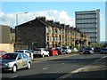
Tenements on Bearsden Road
Bearsden Road (the A739) is a busy road used by thousands of motorists a day. Anniesland Court is in the distance.
Image: © Richard Sutcliffe
Taken: 27 Apr 2018
0.09 miles
9
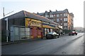
Carry out, shop and laundrette, Fulton Street
NG's Dynasty - Chinese and Cantonese cuisine (carry out and deliveries); Keystore; and Temple Laundrette on Fulton Street. The tenement in the background is on Linden Street.
Image: © Richard Sutcliffe
Taken: 23 Jan 2017
0.09 miles
10
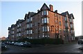
Tenements on Fulton Street at Linden Place
At the corner of Linden Place and Fulton Street. These red sandstone tenements date from 1904, and were owned and managed by the Temple Dwellings Company Limited. The company name is prominently displayed on the wall facing Fulton Street [http://www.geograph.org.uk/photo/5261882].
Image: © Richard Sutcliffe
Taken: 23 Jan 2017
0.10 miles