
IMAGES TAKEN NEAR TO
Exeter Drive, GLASGOW, G11 7UY
Introduction
This page details the photographs taken nearby to Exeter Drive, G11 7UY by members of the Geograph project.
The Geograph project started in 2005 with the aim of publishing, organising and preserving representative images for every square kilometre of Great Britain, Ireland and the Isle of Man.

There are currently over 7.5m images from over14,400 individuals and you can help contribute to the project by visiting https://www.geograph.org.uk
Image Map
Images are licensed for reuse under creativecommons.org/licenses/by-sa/2.0
Notes
- Clicking on the map will re-center to the selected point.
- The higher the marker number, the further away the image location is from the centre of the postcode.
Image Listing (175 Images Found)
Images are licensed for reuse under creativecommons.org/licenses/by-sa/2.0
Image
Details
Distance
1

Exeter Lane pend
A pend on the fairly steep hill that is Exeter Drive. A pend is a vehicle access through the ground floor from the front to the rear of a building. The white glazed brickwork within the pend is intended to reflect the available light.
Image: © Thomas Nugent
Taken: 13 Apr 2013
0.01 miles
2
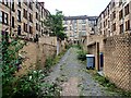
Exeter Lane Glasgow
The back street named Exeter lane, accessed from Exeter Drive just off Dumbarton Road Glasgow.
Image: © Steve Houldsworth
Taken: 20 Aug 2021
0.02 miles
3
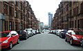
Exeter Drive
Looking down the hill from Kildonan Drive, across Dumbarton Road to Meadow Road with its tiled underpass, Glasgow Harbour and the Govan shipyard all making an appearance.
Image: © Thomas Nugent
Taken: 13 Apr 2013
0.03 miles
4

Corner of Dumbarton Road & Exeter Drive, Glasgow
Image: © Leslie Barrie
Taken: 2 May 2014
0.03 miles
5
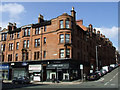
Dumbarton Road
Classic red sandstone Partick tenements at the corner of Exeter Drive.
Image: © Thomas Nugent
Taken: 13 Apr 2013
0.03 miles
6

Exeter Drive
At Kildonan Drive crossroads.
Image: © Thomas Nugent
Taken: 13 Apr 2013
0.04 miles
7
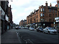
Dumbarton Road
A classic Glasgow main thoroughfare street scene, with fairly grand red sandstone tenements with retail premises on the ground floor. Backstreet tenements are typically residential only, with the occasional corner shop or pub.
Image: © Thomas Nugent
Taken: 13 Apr 2013
0.04 miles
8
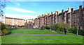
Thornwood Park, Partick
Two lines of the Lanarkshire & Dunbartonshire Railway used to converge here before heading into a tunnel where the modern block of flats now stands.
The Glasgow Story web site has a great photo of the lines in use http://www.theglasgowstory.com/imageview.php?inum=TGSE01354 .
Image: © Thomas Nugent
Taken: 5 Nov 2016
0.04 miles
9

Thornwood Park, Partick
Two lines of the Lanarkshire & Dunbartonshire Railway used to converge here before heading into a tunnel where the modern block of flats now stands.
The Glasgow Story web site has a great photo of the lines in use http://www.theglasgowstory.com/imageview.php?inum=TGSE01354 .
Image: © Thomas Nugent
Taken: 5 Nov 2016
0.04 miles
10
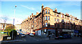
Dumbarton Road
Maude Drive is to the left of the corner building, Thornwood Park is on the extreme left.
Image: © Thomas Nugent
Taken: 5 Nov 2016
0.04 miles