IMAGES TAKEN NEAR TO
Ballam Road, LYTHAM ST. ANNES, FY8 4NJ
Introduction
This page details the photographs taken nearby to Ballam Road, FY8 4NJ by members of the Geograph project.
The Geograph project started in 2005 with the aim of publishing, organising and preserving representative images for every square kilometre of Great Britain, Ireland and the Isle of Man.

There are currently over 7.5m images from over14,400 individuals and you can help contribute to the project by visiting https://www.geograph.org.uk
Image Map
Images are licensed for reuse under creativecommons.org/licenses/by-sa/2.0
Notes
- Clicking on the map will re-center to the selected point.
- The higher the marker number, the further away the image location is from the centre of the postcode.
Image Listing (11 Images Found)
Images are licensed for reuse under creativecommons.org/licenses/by-sa/2.0
Image
Details
Distance
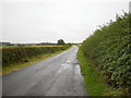
1
Neatly-trimmed hedge alongside Little Birks farmland
Gave me a chance to lick my wounds received from the freer-growing hawthorn further north!
Image: © Barbara Carr
Taken: 15 Nov 2013
0.04 miles
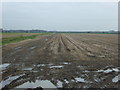
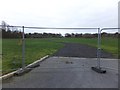
3
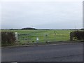
Farmland to the north of Manor House Farm
Farmland to the east of Ballam Road. The notice on the gate is a police warning of court proceedings for any illegal hunting and/or poaching, and further, that any dog found worrying sheep may be shot by an authorised person.
Image: © Barbara Carr
Taken: 15 Nov 2013
0.07 miles
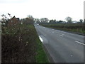
4
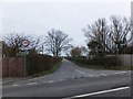
Peg's Lane
Narrow road to the east of Ballam Road, linking it with the B5259 to the north of Eastham Hall.
Image: © Barbara Carr
Taken: 15 Nov 2013
0.07 miles
5
Farmland near Manor House Farm
East of Ballam Road.
Image: © JThomas
Taken: 15 Nov 2014
0.07 miles
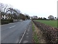
6
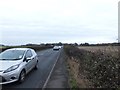
Busy road between High Ballam and Lytham
I was glad to find there was a footpath here, it's a busy road!
Image: © Barbara Carr
Taken: 15 Nov 2013
0.15 miles

8
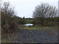
Pond south of Little Birks Farm
This little pond is shown on the larger-scale map.
Image: © Barbara Carr
Taken: 15 Nov 2013
0.17 miles
9
New track into farmland
Not yet on the map, this track is to the west of Ballam Road, heading off towards Long Wood.
Image: © Barbara Carr
Taken: 15 Nov 2013
0.23 miles