IMAGES TAKEN NEAR TO
Worsley Road, LYTHAM ST. ANNES, FY8 4DD
Introduction
This page details the photographs taken nearby to Worsley Road, FY8 4DD by members of the Geograph project.
The Geograph project started in 2005 with the aim of publishing, organising and preserving representative images for every square kilometre of Great Britain, Ireland and the Isle of Man.

There are currently over 7.5m images from over14,400 individuals and you can help contribute to the project by visiting https://www.geograph.org.uk
Image Map
Images are licensed for reuse under creativecommons.org/licenses/by-sa/2.0
Notes
- Clicking on the map will re-center to the selected point.
- The higher the marker number, the further away the image location is from the centre of the postcode.
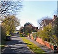
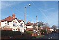
Image Listing (4 Images Found)
Images are licensed for reuse under creativecommons.org/licenses/by-sa/2.0
Image
Details
Distance
1
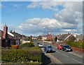
Private Road
At the end of Central Drive where it meets Worsley Road a private road continues towards the Technical College.
Image: © Gerald England
Taken: 15 Apr 2012
0.03 miles
3

Watching the trains go by
In the course of taking a few snaps from a train on the way to Blackpool, I happened to catch this lad sitting on a fence at a pedestrian crossing of the railway. Scenes like this are timeless (apart from changing fashions).
Image: © Stephen Craven
Taken: 17 Nov 2021
0.17 miles