IMAGES TAKEN NEAR TO
Otley Road, LYTHAM ST. ANNES, FY8 3QX
Introduction
This page details the photographs taken nearby to Otley Road, FY8 3QX by members of the Geograph project.
The Geograph project started in 2005 with the aim of publishing, organising and preserving representative images for every square kilometre of Great Britain, Ireland and the Isle of Man.

There are currently over 7.5m images from over14,400 individuals and you can help contribute to the project by visiting https://www.geograph.org.uk
Image Map
Images are licensed for reuse under creativecommons.org/licenses/by-sa/2.0
Notes
- Clicking on the map will re-center to the selected point.
- The higher the marker number, the further away the image location is from the centre of the postcode.
Image Listing (9 Images Found)
Images are licensed for reuse under creativecommons.org/licenses/by-sa/2.0
Image
Details
Distance
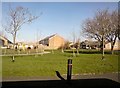
3
Winston Avenue
Residential street to the northeast of Church Road.
Image: © Barbara Carr
Taken: 20 Oct 2013
0.17 miles
4
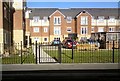
Rigby Court
New apartments on Pilling Avenue.
Image: © Gerald England
Taken: 7 Mar 2014
0.18 miles
6
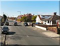
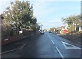
Church Road
From the end of Lyndsay Avenue.
Image: © Gerald England
Taken: 15 Apr 2012
0.19 miles
7
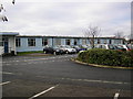
ERNIE's old home
During World War II a number of government departments were evacuated to the Fylde. Barbed wire along the sea wall ( http://www.jp29.org/2pce.htm ) was off-putting to most of the traditional visitors so there were plenty of seaside landladies happy to accommodate the evacuated staff. They worked in offices such as these in Heyhouses Lane. After the war these buildings housed the offices of the Premium Bonds - ERNIE, the random number generator was here - http://www.lightstraw.co.uk/gpo/posb/ernie1.html & http://www.nsandi.com/products/pb/surprisingfacts.jsp . National Savings have moved elsewhere in the Fylde but the offices are still in use by the Department of Health and Social Security.
Image: © Roger W Haworth
Taken: 25 Dec 2005
0.21 miles
8
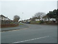
Lindsay Avenue, St Annes on the Sea
Image: © Alexander P Kapp
Taken: 15 Mar 2012
0.22 miles
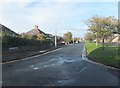
9
Lawrence Avenue
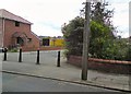
Access into Lawrence Avenue off Church Road is blocked by bollards.
Image: © Gerald England
Taken: 14 Aug 2012
0.24 miles