IMAGES TAKEN NEAR TO
Heeley Road, LYTHAM ST. ANNES, FY8 2LH
Introduction
This page details the photographs taken nearby to Heeley Road, FY8 2LH by members of the Geograph project.
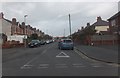
The Geograph project started in 2005 with the aim of publishing, organising and preserving representative images for every square kilometre of Great Britain, Ireland and the Isle of Man.

There are currently over 7.5m images from over14,400 individuals and you can help contribute to the project by visiting https://www.geograph.org.uk
Image Map
Images are licensed for reuse under creativecommons.org/licenses/by-sa/2.0
Notes
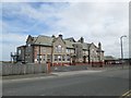
- Clicking on the map will re-center to the selected point.
- The higher the marker number, the further away the image location is from the centre of the postcode.
Image Listing (14 Images Found)
Images are licensed for reuse under creativecommons.org/licenses/by-sa/2.0
Image
Details
Distance
3
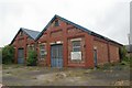
St Annes old council depot
St Annes old council depot, St Andrews Road North, St Annes, Lancashire
Image: © Kevin Hale
Taken: 29 May 2010
0.13 miles
4
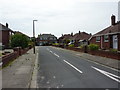
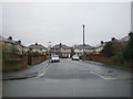
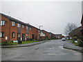
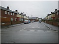
Cross Street, St Anne's
Residential street to the northeast of St David's Road North.
Image: © Barbara Carr
Taken: 27 Oct 2013
0.16 miles
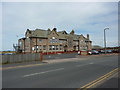
7
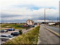
St Anne's Old Links Clubhouse
On Highbury Road West. Behind the golf course is Blackpool Airport.
Image: © Gerald England
Taken: 13 Aug 2012
0.18 miles
9
St. Annes' Old Links Golf Club, Clubhouse
Image: © Alexander P Kapp
Taken: 6 Jul 2010
0.18 miles