IMAGES TAKEN NEAR TO
Burn Hall Industrial Estate, Venture Road, FLEETWOOD, FY7 8RS
Introduction
This page details the photographs taken nearby to Burn Hall Industrial Estate, Venture Road, FY7 8RS by members of the Geograph project.
The Geograph project started in 2005 with the aim of publishing, organising and preserving representative images for every square kilometre of Great Britain, Ireland and the Isle of Man.

There are currently over 7.5m images from over14,400 individuals and you can help contribute to the project by visiting https://www.geograph.org.uk
Image Map
Images are licensed for reuse under creativecommons.org/licenses/by-sa/2.0
Notes
- Clicking on the map will re-center to the selected point.
- The higher the marker number, the further away the image location is from the centre of the postcode.
Image Listing (22 Images Found)
Images are licensed for reuse under creativecommons.org/licenses/by-sa/2.0
Image
Details
Distance
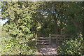
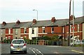
1
Wyre Way Footpath
Leaving the B5268, a messy start with mud and fly tipping.
Image: © Bob Jenkins
Taken: 10 Feb 2009
0.05 miles
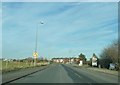
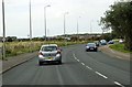
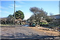
6
Fleetwood Road
Originally this was the A585 but when that was rerouted it became the B5268.
Image: © Gerald England
Taken: 20 Jul 2017
0.11 miles
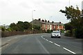
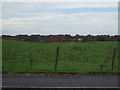
8
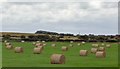
Bales of Hay
In a field off Fleetwood Road.
Image: © Gerald England
Taken: 20 Jul 2017
0.15 miles
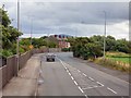
9
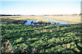
Waste Lands
The symmetry of these flooded depressions indicate its industrial past.
Image: © Bob Jenkins
Taken: 10 Feb 2009
0.18 miles