IMAGES TAKEN NEAR TO
Princes Way, FLEETWOOD, FY7 8PG
Introduction
This page details the photographs taken nearby to Princes Way, FY7 8PG by members of the Geograph project.
The Geograph project started in 2005 with the aim of publishing, organising and preserving representative images for every square kilometre of Great Britain, Ireland and the Isle of Man.

There are currently over 7.5m images from over14,400 individuals and you can help contribute to the project by visiting https://www.geograph.org.uk
Image Map
Images are licensed for reuse under creativecommons.org/licenses/by-sa/2.0
Notes
- Clicking on the map will re-center to the selected point.
- The higher the marker number, the further away the image location is from the centre of the postcode.
Image Listing (92 Images Found)
Images are licensed for reuse under creativecommons.org/licenses/by-sa/2.0
Image
Details
Distance
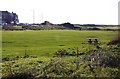
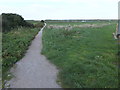
7
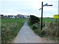
The path from the dunes meets Princes Way
Image: © Barbara Carr
Taken: 25 Oct 2013
0.08 miles
8
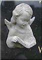
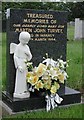
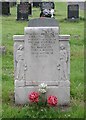
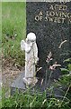
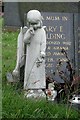
Fleetwood Cemetery - detail from gravestone
Image: © John Salmon
Taken: 19 Jul 2001
0.09 miles
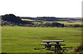
9
Path to the prom
This path leads from Princes Way to the outer promenade, which is a part of the Lancashire Coastal Way.
Image: © Barbara Carr
Taken: 25 Oct 2013
0.11 miles