IMAGES TAKEN NEAR TO
Edenfield Avenue, POULTON-LE-FYLDE, FY6 8HS
Introduction
This page details the photographs taken nearby to Edenfield Avenue, FY6 8HS by members of the Geograph project.
The Geograph project started in 2005 with the aim of publishing, organising and preserving representative images for every square kilometre of Great Britain, Ireland and the Isle of Man.

There are currently over 7.5m images from over14,400 individuals and you can help contribute to the project by visiting https://www.geograph.org.uk
Image Map (Loading...)


Getting Data...Please wait
Leaflet Map data © OpenStreetMap
Images are licensed for reuse under creativecommons.org/licenses/by-sa/2.0
Notes
- Clicking on the map will re-center to the selected point.
- The higher the marker number, the further away the image location is from the centre of the postcode.
Image Listing (11 Images Found)
Images are licensed for reuse under creativecommons.org/licenses/by-sa/2.0
Image
Details
Distance
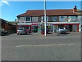
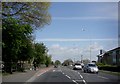
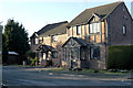
1
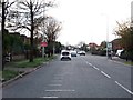
Garstang Road East in Poulton-Le-Fylde
Image: © Steve Daniels
Taken: 30 Oct 2017
0.14 miles
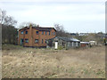
4
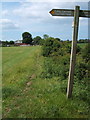
The footpath junction looking towards Old Field Carr Farm
Image: © Stephen Moore
Taken: 5 Jun 2007
0.17 miles
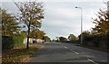
8
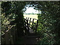
Bridge over the Dyke walking from Holts Lane
Image: © Stephen Moore
Taken: 5 Jun 2007
0.21 miles

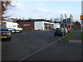
10
New houses Sheringham Way, Poulton-Le-Fylde
Image: © Tom Richardson
Taken: 6 Jan 2009
0.24 miles