IMAGES TAKEN NEAR TO
Garnet Close, POULTON-LE-FYLDE, FY6 7XU
Introduction
This page details the photographs taken nearby to Garnet Close, FY6 7XU by members of the Geograph project.
The Geograph project started in 2005 with the aim of publishing, organising and preserving representative images for every square kilometre of Great Britain, Ireland and the Isle of Man.

There are currently over 7.5m images from over14,400 individuals and you can help contribute to the project by visiting https://www.geograph.org.uk
Image Map (Loading...)


Getting Data...Please wait
Leaflet Map data © OpenStreetMap
Images are licensed for reuse under creativecommons.org/licenses/by-sa/2.0
Notes
- Clicking on the map will re-center to the selected point.
- The higher the marker number, the further away the image location is from the centre of the postcode.
Image Listing (14 Images Found)
Images are licensed for reuse under creativecommons.org/licenses/by-sa/2.0
Image
Details
Distance
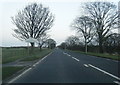
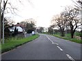
2
Footpath to Little Poulton Lane
Off Garstang Road East.
Image: © JThomas
Taken: 29 Nov 2014
0.03 miles
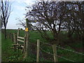
5
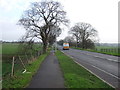
Path beside Garstang Road East
Looking east.
Image: © JThomas
Taken: 29 Nov 2014
0.09 miles
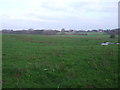
7
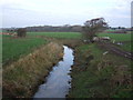
Main Dyke
Looking north from Garstang Road.
Image: © JThomas
Taken: 29 Nov 2014
0.09 miles
8
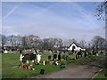
Poulton Cemetery Garstang Road
Poulton Cemetery Garstang Road,founded in 1929.
Image: © Steve Houldsworth
Taken: Unknown
0.11 miles
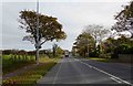
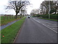
9
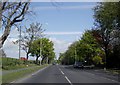
A 586 between Poulton and Little Singleton
Image: © Peter Bond
Taken: 15 May 2010
0.12 miles