IMAGES TAKEN NEAR TO
Moorfield Avenue, POULTON-LE-FYLDE, FY6 7QE
Introduction
This page details the photographs taken nearby to Moorfield Avenue, FY6 7QE by members of the Geograph project.
The Geograph project started in 2005 with the aim of publishing, organising and preserving representative images for every square kilometre of Great Britain, Ireland and the Isle of Man.

There are currently over 7.5m images from over14,400 individuals and you can help contribute to the project by visiting https://www.geograph.org.uk
Image Map (Loading...)


Getting Data...Please wait
Leaflet Map data © OpenStreetMap
Images are licensed for reuse under creativecommons.org/licenses/by-sa/2.0
Notes
- Clicking on the map will re-center to the selected point.
- The higher the marker number, the further away the image location is from the centre of the postcode.
Image Listing (18 Images Found)
Images are licensed for reuse under creativecommons.org/licenses/by-sa/2.0
Image
Details
Distance
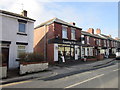
1
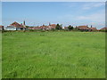
Bungalows and Fields
The southern extent of Carleton
Image: © Alex Robinson
Taken: 26 Jul 2008
0.06 miles
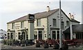
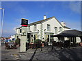
3
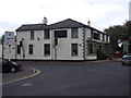
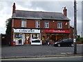
Carleton Crossroads
A busy crossroads, with the large Castle Gardens public house occupying one corner.
Image: © Bob Jenkins
Taken: 13 Oct 2009
0.09 miles
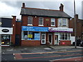
5
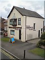
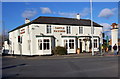
Poulton Chiropractic & Massage Clinic
On Blackpool Road, Four Lane Ends, Carleton.
Image: © Gerald England
Taken: 20 Jul 2017
0.12 miles