IMAGES TAKEN NEAR TO
Minstrel Walk, POULTON-LE-FYLDE, FY6 7EF

Introduction

This page details the photographs taken nearby to Minstrel Walk, FY6 7EF by members of the Geograph project.

The Geograph project started in 2005 with the aim of publishing, organising and preserving representative images for every square kilometre of Great Britain, Ireland and the Isle of Man.

There are currently over 7.5m images from over14,400 individuals and you can help contribute to the project by visiting https://www.geograph.org.uk

Image Map


Images are licensed for reuse under creativecommons.org/licenses/by-sa/2.0
Notes
  • Clicking on the map will re-center to the selected point.
  • The higher the marker number, the further away the image location is from the centre of the postcode.

Image Listing (56 Images Found)

Images are licensed for reuse under creativecommons.org/licenses/by-sa/2.0
  • ...
Image
Details
Distance
1
Poulton Civic Centre from the back
Image: © Peter Bond Taken: 23 Apr 2009
0.08 miles
2
Poulton Civic Centre
This building, now a civic centre, was a convalescent home for the cotton industry in the 1950s. Later in the 1980s it was a campus for Preston Polytechnic - now University of Central Lancashire - where I was a student. The place was said to have a ghost in those days but I never saw it.
Image: © Peter Bond Taken: 23 Apr 2009
0.13 miles
3
Tithebarn Place, Poulton le Fylde
Image: © Ian S Taken: 10 Mar 2012
0.17 miles
4
Football Pitch behind Poulton Civic Centre
Image: © Peter Bond Taken: 23 Apr 2009
0.17 miles
5
Diverging railways, Poulton-le-Fylde
Poulton No.3 Signal Box in the middle.
Image: © JThomas Taken: 19 Oct 2013
0.17 miles
6
Railway west of Poulton-le-Fylde Station
The line to the right goes to Fleetwood and the line to the left goes to Blackpool. The station at Fleetwood has been closed for a number of years.
Image: © Alexander P Kapp Taken: 9 Sep 2008
0.18 miles
7
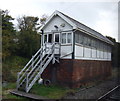
Poulton No.3 Signal Box
Image: © JThomas Taken: 19 Oct 2013
0.18 miles
8
Tithebarn Street in Poulton-Le-Fylde
Image: © Steve Daniels Taken: 30 Oct 2017
0.18 miles
9
Poulton Signal Box
Image: © David Dixon Taken: 1 Sep 2011
0.18 miles
10
Poulton Curve Halt (site), Lancashire
Opened in 1909 by the Preston & Wyre Joint Railway line from Blackpool to Fleetwood, this small station closed in 1952. View south west towards Layton and Blackpool. Decayed remains of one of the wooden platforms can be made out to the left. The bridge carrying Tithebarn Street over the former railway can also be seen.
Image: © Nigel Thompson Taken: 13 Jul 2018
0.19 miles
  • ...