IMAGES TAKEN NEAR TO
Willow Grove Park, Sandy Lane, POULTON-LE-FYLDE, FY6 0RT
Introduction
This page details the photographs taken nearby to Willow Grove Park, Sandy Lane, FY6 0RT by members of the Geograph project.
The Geograph project started in 2005 with the aim of publishing, organising and preserving representative images for every square kilometre of Great Britain, Ireland and the Isle of Man.

There are currently over 7.5m images from over14,400 individuals and you can help contribute to the project by visiting https://www.geograph.org.uk
Image Map
Images are licensed for reuse under creativecommons.org/licenses/by-sa/2.0
Notes
- Clicking on the map will re-center to the selected point.
- The higher the marker number, the further away the image location is from the centre of the postcode.
Image Listing (10 Images Found)
Images are licensed for reuse under creativecommons.org/licenses/by-sa/2.0
Image
Details
Distance

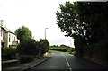
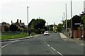
2
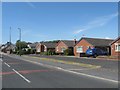
Roadside bungalows on the north side of Preesall
Image: © James Denham
Taken: 23 Jun 2014
0.07 miles

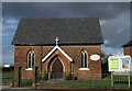
10
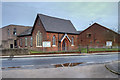
Bethel United Reformed Church, Lancaster Road, Preesall
This church was founded in 1835 as Bethel Congregational Church. In 1972 the Congregational church joined with the English Presbyterian church to become the United Reformed Church.
Image: © David Dixon
Taken: 2 Feb 2020
0.24 miles