IMAGES TAKEN NEAR TO
Cartgate, POULTON-LE-FYLDE, FY6 0NP
Introduction
This page details the photographs taken nearby to Cartgate, FY6 0NP by members of the Geograph project.
The Geograph project started in 2005 with the aim of publishing, organising and preserving representative images for every square kilometre of Great Britain, Ireland and the Isle of Man.

There are currently over 7.5m images from over14,400 individuals and you can help contribute to the project by visiting https://www.geograph.org.uk
Image Map (Loading...)


Getting Data...Please wait
Leaflet Map data © OpenStreetMap
Images are licensed for reuse under creativecommons.org/licenses/by-sa/2.0
Notes
- Clicking on the map will re-center to the selected point.
- The higher the marker number, the further away the image location is from the centre of the postcode.
Image Listing (25 Images Found)
Images are licensed for reuse under creativecommons.org/licenses/by-sa/2.0
Image
Details
Distance
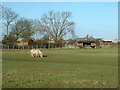
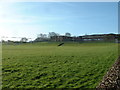
1
Horse Stables
Taken from the Preesall hill.
Image: © Bob Jenkins
Taken: 23 Feb 2009
0.05 miles

8
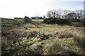
Footbridge and Path to School
The Primary School sits on top of the moraine hill.
Image: © Bob Jenkins
Taken: 23 Feb 2009
0.17 miles