IMAGES TAKEN NEAR TO
Ashdale Grove, THORNTON-CLEVELEYS, FY5 5NW
Introduction
This page details the photographs taken nearby to Ashdale Grove, FY5 5NW by members of the Geograph project.
The Geograph project started in 2005 with the aim of publishing, organising and preserving representative images for every square kilometre of Great Britain, Ireland and the Isle of Man.

There are currently over 7.5m images from over14,400 individuals and you can help contribute to the project by visiting https://www.geograph.org.uk
Image Map
Images are licensed for reuse under creativecommons.org/licenses/by-sa/2.0
Notes
- Clicking on the map will re-center to the selected point.
- The higher the marker number, the further away the image location is from the centre of the postcode.
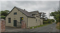
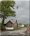
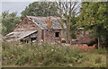
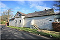
Image Listing (10 Images Found)
Images are licensed for reuse under creativecommons.org/licenses/by-sa/2.0
Image
Details
Distance
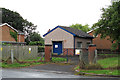
1
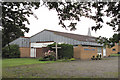
St Nicholas Owen Roman Catholic Church, Thornton
Image: © JThomas
Taken: 19 Oct 2013
0.09 miles
2
St. Nicolas Owen R.C. Church, Thornton-Cleveleys
Image: © Tom Richardson
Taken: 15 Jun 2010
0.11 miles
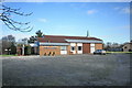
4
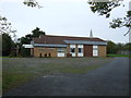
Wastewater pumping station, Raikes Road Thornton-Cleveleys
Image: © Tom Richardson
Taken: 15 Jun 2010
0.14 miles
5
St Nicholas Owen RC Church
Its first Mass was celebrated 31 May 1874.
Image: © Bob Jenkins
Taken: 10 Feb 2009
0.14 miles