IMAGES TAKEN NEAR TO
Bleasdale Avenue, THORNTON-CLEVELEYS, FY5 3QZ
Introduction
This page details the photographs taken nearby to Bleasdale Avenue, FY5 3QZ by members of the Geograph project.
The Geograph project started in 2005 with the aim of publishing, organising and preserving representative images for every square kilometre of Great Britain, Ireland and the Isle of Man.

There are currently over 7.5m images from over14,400 individuals and you can help contribute to the project by visiting https://www.geograph.org.uk
Image Map
Images are licensed for reuse under creativecommons.org/licenses/by-sa/2.0
Notes
- Clicking on the map will re-center to the selected point.
- The higher the marker number, the further away the image location is from the centre of the postcode.
Image Listing (13 Images Found)
Images are licensed for reuse under creativecommons.org/licenses/by-sa/2.0
Image
Details
Distance
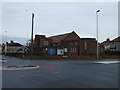
6
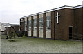
All Saints Church, Anchorsholme
My eldest daughter got married here
Image: © Tom Richardson
Taken: 10 Jan 2009
0.17 miles
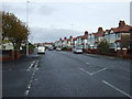
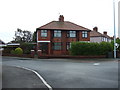
8
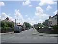
Cresswood Avenue - Anchorsholme Lane East
Image: © Betty Longbottom
Taken: 29 Jun 2011
0.22 miles
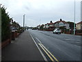
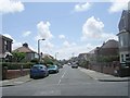
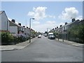
9
Rochford Avenue - Anchorsholme Lane East
Image: © Betty Longbottom
Taken: 29 Jun 2011
0.22 miles
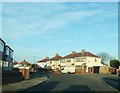
10
Rookwood Avenue - Anchorsholme Lane East
Image: © Betty Longbottom
Taken: 29 Jun 2011
0.23 miles