IMAGES TAKEN NEAR TO
Common Edge Road, BLACKPOOL, FY4 5DJ
Introduction
This page details the photographs taken nearby to Common Edge Road, FY4 5DJ by members of the Geograph project.
The Geograph project started in 2005 with the aim of publishing, organising and preserving representative images for every square kilometre of Great Britain, Ireland and the Isle of Man.

There are currently over 7.5m images from over14,400 individuals and you can help contribute to the project by visiting https://www.geograph.org.uk
Image Map
Images are licensed for reuse under creativecommons.org/licenses/by-sa/2.0
Notes
- Clicking on the map will re-center to the selected point.
- The higher the marker number, the further away the image location is from the centre of the postcode.
Image Listing (10 Images Found)
Images are licensed for reuse under creativecommons.org/licenses/by-sa/2.0
Image
Details
Distance
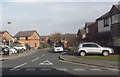
1
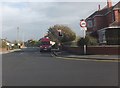
School Road
At the junction with Common Edge Road, to the east of Blackpool Airport.
Image: © Barbara Carr
Taken: 27 Oct 2013
0.10 miles
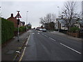
2
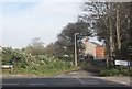
Ecclesgate Road
The public footpath along this road leads northeasterly to Peel Hill.
Image: © Barbara Carr
Taken: 27 Oct 2013
0.12 miles
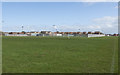
6
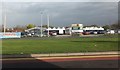
Trebaron Garden Centre
On Common Edge Road, to the east of Blackpool Airport.
Image: © Barbara Carr
Taken: 27 Oct 2013
0.19 miles
7
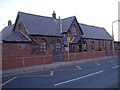
St Nicholas Church of England Primary School
Image: © Paul Twambley
Taken: 27 Dec 2005
0.20 miles
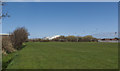
9
Belverdale Gardens
Residential area to the northeast of Common Edge Road.
Image: © Barbara Carr
Taken: 27 Oct 2013
0.21 miles
10
School Road, Great Marton Moss
Heading south west.
Image: © JThomas
Taken: 15 Nov 2014
0.22 miles