IMAGES TAKEN NEAR TO
Weeton Avenue, BLACKPOOL, FY4 3QW
Introduction
This page details the photographs taken nearby to Weeton Avenue, FY4 3QW by members of the Geograph project.
The Geograph project started in 2005 with the aim of publishing, organising and preserving representative images for every square kilometre of Great Britain, Ireland and the Isle of Man.

There are currently over 7.5m images from over14,400 individuals and you can help contribute to the project by visiting https://www.geograph.org.uk
Image Map
Images are licensed for reuse under creativecommons.org/licenses/by-sa/2.0
Notes
- Clicking on the map will re-center to the selected point.
- The higher the marker number, the further away the image location is from the centre of the postcode.
Image Listing (13 Images Found)
Images are licensed for reuse under creativecommons.org/licenses/by-sa/2.0
Image
Details
Distance
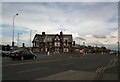
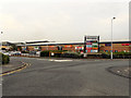
2
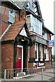
Halfway House
At the end of St Annes Road.
Image: © Gerald England
Taken: 1 May 2010
0.13 miles
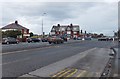
3
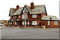
Halfway House
Large public house at the corner of St Anne's Road and Squires Gate Lane.
Image: © David Dixon
Taken: 12 Aug 2012
0.14 miles
4
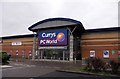
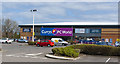
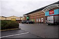
Currys retail outlet on Squiresgate Retail Park
Image: © Steve Daniels
Taken: 7 Jun 2012
0.14 miles
5
Halfway House
Public house at the junction of St Annes Road and Squires Gate Lane.
Image: © Gerald England
Taken: 1 May 2010
0.14 miles
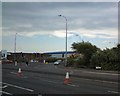
6
Approaching traffic lights by Halfway House
Image: © Peter Bond
Taken: 11 Jan 2012
0.15 miles
7
Squires Gate Lane (the A5230)
At the Halfway House junction.
Image: © Barbara Carr
Taken: 25 Oct 2013
0.16 miles
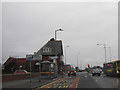
8
Squires Gate Lane
The entrance to Blackpool International Airport.
Image: © Gerald England
Taken: 19 Jun 2013
0.16 miles
9
Retail units on Squiresgate Retail Park
Image: © Steve Daniels
Taken: 7 Jun 2012
0.20 miles
10
Blackpool Retail Park
The retail park next to the airport.
Image: © David Dixon
Taken: 12 Aug 2012
0.21 miles