IMAGES TAKEN NEAR TO
Malham Avenue, BLACKPOOL, FY4 3DY
Introduction
This page details the photographs taken nearby to Malham Avenue, FY4 3DY by members of the Geograph project.
The Geograph project started in 2005 with the aim of publishing, organising and preserving representative images for every square kilometre of Great Britain, Ireland and the Isle of Man.

There are currently over 7.5m images from over14,400 individuals and you can help contribute to the project by visiting https://www.geograph.org.uk
Image Map
Images are licensed for reuse under creativecommons.org/licenses/by-sa/2.0
Notes
- Clicking on the map will re-center to the selected point.
- The higher the marker number, the further away the image location is from the centre of the postcode.
Image Listing (10 Images Found)
Images are licensed for reuse under creativecommons.org/licenses/by-sa/2.0
Image
Details
Distance
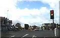
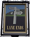
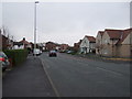
2
Harcourt Road
With a Tesco Express opposite the end
Image: © Ian Greig
Taken: 30 Apr 2018
0.13 miles
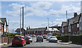
5
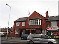
The Marton Social Club on Daggers Hall Lane
A Sam Smith's owned club in Blackpool.
Image: © Ian S
Taken: 10 Mar 2012
0.22 miles
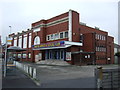
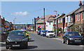
9
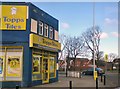
Topps Tiles
On the corner of Waterloo Road and Marton Drive.
Image: © Gerald England
Taken: 14 Apr 2012
0.23 miles