IMAGES TAKEN NEAR TO
Seventh Avenue, BLACKPOOL, FY4 2ED
Introduction
This page details the photographs taken nearby to Seventh Avenue, FY4 2ED by members of the Geograph project.
The Geograph project started in 2005 with the aim of publishing, organising and preserving representative images for every square kilometre of Great Britain, Ireland and the Isle of Man.

There are currently over 7.5m images from over14,400 individuals and you can help contribute to the project by visiting https://www.geograph.org.uk
Image Map (Loading...)


Getting Data...Please wait
Leaflet Map data © OpenStreetMap
Images are licensed for reuse under creativecommons.org/licenses/by-sa/2.0
Notes
- Clicking on the map will re-center to the selected point.
- The higher the marker number, the further away the image location is from the centre of the postcode.
Image Listing (12 Images Found)
Images are licensed for reuse under creativecommons.org/licenses/by-sa/2.0
Image
Details
Distance
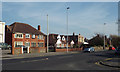
2
Third Avenue
Looking north up Third Avenue from Arnold Avenue.
Image: © David P Howard
Taken: 20 Apr 2015
0.08 miles
3
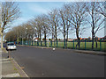
Playing fields of the closed Arnold School by Arnold Avenue, Blackpool
Image: © Robin Stott
Taken: 20 Apr 2015
0.10 miles
5
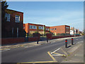
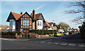
Buildings of the closed Arnold School, Arnold Avenue, Blackpool
Image: © Robin Stott
Taken: 20 Apr 2015
0.18 miles
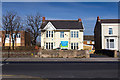
6
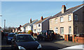
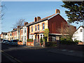
Fenber Avenue, South Shore, Blackpool
These look like former council houses.
Image: © Robin Stott
Taken: 20 Apr 2015
0.19 miles
7
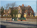
Arnold School boarded up, Lytham Road, Blackpool
Seen from the corner of Rosebery Avenue.
Image: © Robin Stott
Taken: 20 Apr 2015
0.21 miles
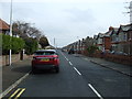
9
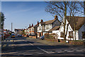
Properties in Lytham Road, Blackpool
The view is from the corner of Rosebery Avenue, a little to the right (south) of Image
Image: © Robin Stott
Taken: 20 Apr 2015
0.23 miles
10
Butterfly Lodge Nursery, Lytham Road
View east from Rosebery Avenue, at the junction with Lytham Road.
Image: © David P Howard
Taken: 20 Apr 2015
0.23 miles