IMAGES TAKEN NEAR TO
Watson Road, BLACKPOOL, FY4 2DD
Introduction
This page details the photographs taken nearby to Watson Road, FY4 2DD by members of the Geograph project.
The Geograph project started in 2005 with the aim of publishing, organising and preserving representative images for every square kilometre of Great Britain, Ireland and the Isle of Man.

There are currently over 7.5m images from over14,400 individuals and you can help contribute to the project by visiting https://www.geograph.org.uk
Image Map
Images are licensed for reuse under creativecommons.org/licenses/by-sa/2.0
Notes
- Clicking on the map will re-center to the selected point.
- The higher the marker number, the further away the image location is from the centre of the postcode.
Image Listing (17 Images Found)
Images are licensed for reuse under creativecommons.org/licenses/by-sa/2.0
Image
Details
Distance
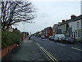
4
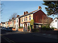
Fenber Avenue, South Shore, Blackpool
These look like former council houses.
Image: © Robin Stott
Taken: 20 Apr 2015
0.12 miles
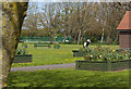
5
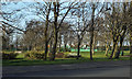
Watson Road Park, South Shore, Blackpool
Towards the back is a multi-use games area or MUGA. The boundary beyond, in shadow, is Yeadon Way on its embankment – the line of a former railway.
"Yeadon Way is the main access into Blackpool for tourists. It is a converted railway linking the M55 (via a short stretch of A5230) to car parks near the beach. As a railway conversion it bridges over several roads without junctions." (See Image ). "The railway conversion continues as Seasiders Way, though mostly at-grade, linking to more car parks.
It is named after Harry Yeadon, a prominent civil engineer for Lancashire. Yeadon worked on the Preston Bypass and many other early motorways and then succeeded Sir James Drake as County Surveyor and Bridgemaster. As a retirement gift, his colleagues named this road, the only one under-construction at the time, after him."
Thanks to Gerald England for directing me to the Sabre website for the above information http://www.sabre-roads.org.uk/wiki/index.php?title=Yeadon_Way
Image: © Robin Stott
Taken: 20 Apr 2015
0.16 miles
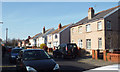
8
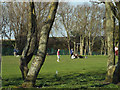
Late afternoon, Watson Road Park, South Shore, Blackpool
A couple strolls to a quieter place; lads kick a ball about; friends sit on the grass and chat – these are the things that parks are for. Defend!
The boundary beyond, in shadow, is Yeadon Way on its embankment – the line of a former railway: see Image
Image: © Robin Stott
Taken: 20 Apr 2015
0.17 miles
9
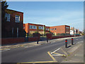
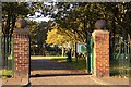
Buildings of the closed Arnold School, Arnold Avenue, Blackpool
Image: © Robin Stott
Taken: 20 Apr 2015
0.18 miles
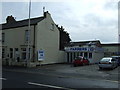
10
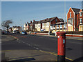
Premises and a postbox on Lytham Road, Blackpool
The boarded-up buildings appear to be part of the former Arnold School. The postbox is number FY4 9. The view is from near the corner of Burlington Road.
Image: © Robin Stott
Taken: 20 Apr 2015
0.18 miles