
IMAGES TAKEN NEAR TO
Melrose Avenue, BLACKPOOL, FY3 7ES
Introduction
This page details the photographs taken nearby to Melrose Avenue, FY3 7ES by members of the Geograph project.
The Geograph project started in 2005 with the aim of publishing, organising and preserving representative images for every square kilometre of Great Britain, Ireland and the Isle of Man.

There are currently over 7.5m images from over14,400 individuals and you can help contribute to the project by visiting https://www.geograph.org.uk
Image Map
Images are licensed for reuse under creativecommons.org/licenses/by-sa/2.0
Notes
- Clicking on the map will re-center to the selected point.
- The higher the marker number, the further away the image location is from the centre of the postcode.
Image Listing (17 Images Found)
Images are licensed for reuse under creativecommons.org/licenses/by-sa/2.0
Image
Details
Distance
1
St.Mary's Catholic College
On the A587 St.Walburga's Road in Blackpool, just north of the Zoo and Victoria Hospital.
Image: © Roger May
Taken: 7 Nov 2005
0.03 miles
3
The Layton Institute, Westcliffe Drive, Layton
Image: © Tom Richardson
Taken: 10 Jan 2009
0.17 miles
4
Granby Avenue, Hoohill
Residential area to the west of the A586.
Image: © Barbara Carr
Taken: 17 Nov 2013
0.18 miles
5
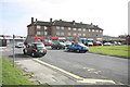
Shops on Grange Park Estate
Just off Chepstow Avenue
Image: © Bob Jenkins
Taken: 9 Mar 2009
0.19 miles
6
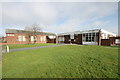
Christ the King Church and Social Centre
On the Grange Park Estate, looking rather tired.
Image: © Bob Jenkins
Taken: 9 Mar 2009
0.19 miles
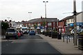
8
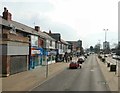
Westcliffe Drive, Layton
The A586 from Poulton-le-Fylde to Blackpool
Image: © Gerald England
Taken: 8 Apr 2013
0.20 miles
9
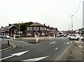
Westcliffe Drive, Layton
The A586 out of Blackpool. The RBS bank is on the corner of Annesley Avenue.
Image: © Gerald England
Taken: 23 Sep 2013
0.21 miles
10
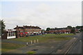
Shopping Centre off Chepstow Road, Grange Farm Estate
Image: © Chris
Taken: 31 Jul 2014
0.23 miles