IMAGES TAKEN NEAR TO
St. Bernard Avenue, BLACKPOOL, FY3 7EH
Introduction
This page details the photographs taken nearby to St. Bernard Avenue, FY3 7EH by members of the Geograph project.
The Geograph project started in 2005 with the aim of publishing, organising and preserving representative images for every square kilometre of Great Britain, Ireland and the Isle of Man.

There are currently over 7.5m images from over14,400 individuals and you can help contribute to the project by visiting https://www.geograph.org.uk
Image Map (Loading...)


Getting Data...Please wait
Leaflet Map data © OpenStreetMap
Images are licensed for reuse under creativecommons.org/licenses/by-sa/2.0
Notes
- Clicking on the map will re-center to the selected point.
- The higher the marker number, the further away the image location is from the centre of the postcode.
Image Listing (6 Images Found)
Images are licensed for reuse under creativecommons.org/licenses/by-sa/2.0
Image
Details
Distance
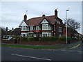
1
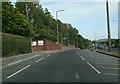
St Walburgas Road near St Mary's College
Image: © Peter Bond
Taken: 20 Jun 2010
0.05 miles
2
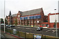
Work in Progress at St. Mary's Catholic College, St. Walburga's Road
Image: © Chris
Taken: 31 Jul 2014
0.05 miles
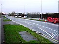
6
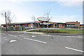
New Community Centre, Grange Park
Situated on the corner of Dinmore Ave and Bathurst Ave, and part of a regeneration programme for this council estate.
Image: © Bob Jenkins
Taken: 9 Mar 2009
0.25 miles