
IMAGES TAKEN NEAR TO
Holyoake Avenue, BLACKPOOL, FY2 0QL
Introduction
This page details the photographs taken nearby to Holyoake Avenue, FY2 0QL by members of the Geograph project.
The Geograph project started in 2005 with the aim of publishing, organising and preserving representative images for every square kilometre of Great Britain, Ireland and the Isle of Man.

There are currently over 7.5m images from over14,400 individuals and you can help contribute to the project by visiting https://www.geograph.org.uk
Image Map
Images are licensed for reuse under creativecommons.org/licenses/by-sa/2.0
Notes
- Clicking on the map will re-center to the selected point.
- The higher the marker number, the further away the image location is from the centre of the postcode.
Image Listing (22 Images Found)
Images are licensed for reuse under creativecommons.org/licenses/by-sa/2.0
Image
Details
Distance
1
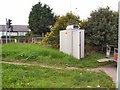
Smoke Detector
This is one of many roadside Air Quality testing stations used to monitor pollution levels in sensitive areas. This one is located at the junction of Mowbray Drive, Little Carleton, Blackpool
Image: © Roger May
Taken: 7 Sep 2005
0.05 miles
4
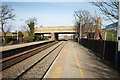
Railway Bridge at Layton
The A587 - Plymouth Road - crosses the train line from Blackpool North.
Image: © Bob Jenkins
Taken: 9 Mar 2009
0.17 miles
5
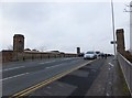
Railway bridge, Plymouth Road
The bridge was opened by the Earl of Plymouth on the 10th June 1932, see Image
Image: © Barbara Carr
Taken: 17 Nov 2013
0.18 miles
6
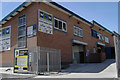
Industrial units, Chorley Road, Blackpool
Image: © Tom Richardson
Taken: 5 Jul 2008
0.19 miles
7
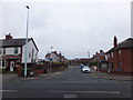
Sidney Avenue
Residential street to the west of Bispham Road, Warbreck.
Image: © Barbara Carr
Taken: 17 Nov 2013
0.19 miles
8
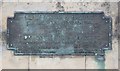
Plaque on railway bridge, Plymouth Road
See Image for a picture of the bridge.
Image: © Barbara Carr
Taken: 17 Nov 2013
0.19 miles
9
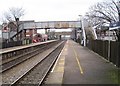
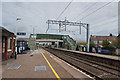
Layton railway station, Lancashire, 2010
Opened in 1868 as "Bispham" by the Preston & Wyre Joint Railway on its line from Preston to Blackpool Talbot Road (now Blackpool North), it was renamed "Layton" in 1938.
View north east towards Poulton-le-Fylde and Preston some 8 years before the line was electrified and the footbridge replaced. See Image for a similar view taken 8 years later.
Image: © Nigel Thompson
Taken: 25 Jan 2010
0.19 miles
10
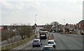
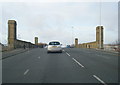
Plymouth Road, Layton
The A587 from Cleveleys to Great Marton approaching the right turn into Benson Road.
Image: © Gerald England
Taken: 8 Apr 2013
0.19 miles