IMAGES TAKEN NEAR TO
Jeffrey Square, BLACKPOOL, FY1 5LR
Introduction
This page details the photographs taken nearby to Jeffrey Square, FY1 5LR by members of the Geograph project.
The Geograph project started in 2005 with the aim of publishing, organising and preserving representative images for every square kilometre of Great Britain, Ireland and the Isle of Man.

There are currently over 7.5m images from over14,400 individuals and you can help contribute to the project by visiting https://www.geograph.org.uk
Image Map (Loading...)


Getting Data...Please wait
Leaflet Map data © OpenStreetMap
Images are licensed for reuse under creativecommons.org/licenses/by-sa/2.0
Notes
- Clicking on the map will re-center to the selected point.
- The higher the marker number, the further away the image location is from the centre of the postcode.
Image Listing (18 Images Found)
Images are licensed for reuse under creativecommons.org/licenses/by-sa/2.0
Image
Details
Distance
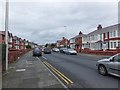
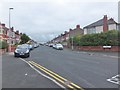
2
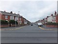
Keswick Road, Blackpool
The streets in this area of the suburbs have Cumbrian names.
Image: © Barbara Carr
Taken: 26 Oct 2013
0.13 miles
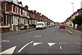
4
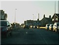
Condor Grove, approaching junction of Park Road
Image: © Peter Bond
Taken: 15 Jan 2012
0.14 miles
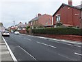
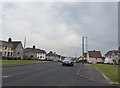
7
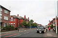
Revoe: Grasmere Road, black cab, and Revoe Community Primary School
Image: © Chris
Taken: 31 Jul 2014
0.17 miles
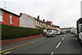
8
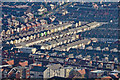
Blackpool : Housing & Scenery
Looking towards rooftops and houses from the Blackpool Tower.
Image: © Lewis Clarke
Taken: 12 Oct 2014
0.17 miles