
IMAGES TAKEN NEAR TO
Chisholm Avenue, STIRLING, FK9 5QT
Introduction
This page details the photographs taken nearby to Chisholm Avenue, FK9 5QT by members of the Geograph project.
The Geograph project started in 2005 with the aim of publishing, organising and preserving representative images for every square kilometre of Great Britain, Ireland and the Isle of Man.

There are currently over 7.5m images from over14,400 individuals and you can help contribute to the project by visiting https://www.geograph.org.uk
Image Map
Images are licensed for reuse under creativecommons.org/licenses/by-sa/2.0
Notes
- Clicking on the map will re-center to the selected point.
- The higher the marker number, the further away the image location is from the centre of the postcode.
Image Listing (7 Images Found)
Images are licensed for reuse under creativecommons.org/licenses/by-sa/2.0
Image
Details
Distance
1
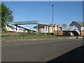
Railway Footbridge, Cornton, Stirling
About a mile north of Stirling railweay station.
Image: © G Laird
Taken: 6 May 2017
0.16 miles
2

Railway, Cornton
Viewed from the footbridge linking Cornton and Causewayhead. Look closely and you can see a train heading for Bridge of Allan, and also a stripe across the tracks which is the pedestrian level crossing on Easter Cornton Road.
Image: © Andrew Smith
Taken: 27 Jun 2006
0.18 miles

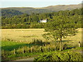
5
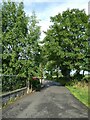
Stirling - Easter Cornton Road
Easter Cornton Road is a leafy suburban road towards the north of the city of Stirling. It comes to a dead-end a view yards further on as it reaches the railway line without a crossing (there may be a pedestrian crossing). The road carries on in name on the other side of the railway however.
Image: © Rob Farrow
Taken: 3 Jul 2022
0.23 miles

7
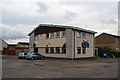
The Chalet, Cornton
A pub which is off the main road, built to service the estate.
Image: © Bill Boaden
Taken: 8 Aug 2013
0.24 miles