1
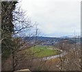
View towards Causewayhead from Wallace Monument
Image: © Colin Park
Taken: 17 Apr 1982
0.02 miles
2
Causewayhead from the Wallace Monument
Looking south west over Causewayhead and the River Forth towards Stirling Castle.
Image: © Gordon Hatton
Taken: Unknown
0.03 miles
3
Stirling from the Wallace Monument
Stirling Castle is in the distance on the right and a train heads along the railway line in the bottom right. The Battle of Stirling Bridge was fought in the loop of the Forth on the right.
Image: © Mike Pennington
Taken: 4 May 2009
0.07 miles
4
Site of Causewayhead station, 1986
View NE, towards Alloa and Dunfermline: ex-NBR Stirling - Alloa - Dunfermline line. The station had been closed earlier (4/7/55), the Stirling - Alloa - Dunfermline passenger service ceasing from 4/10/68, but the line remained open for occasional goods. However, it was restored again, to a rebuilt station at Alloa on 15/5/08.
Image: © Ben Brooksbank
Taken: 28 Jun 1986
0.10 miles
5
View towards Stirling Castle
View from near the base of the National Wallace Monument over the meandering River Forth below towards Stirling Castle.
Image: © Gerald England
Taken: 22 Mar 2017
0.13 miles
6
Ordnance Survey Flush Bracket G661
This bracket can be found on the wall of a private dwelling in Causwayhead Road, Stirling. The benchmark height is recorded as being 9.502 metres above seal level. For more detail see : http://www.bench-marks.org.uk/bm20331
Image: © Peter Wood
Taken: 4 Oct 2017
0.14 miles
7
House on Causewayhead Road
Image: © Eirian Evans
Taken: 7 Sep 2021
0.15 miles
8
Road to Causewayhead
With the Wallace Monument in the background.
Image: © Trevor Harris
Taken: 27 Oct 2010
0.15 miles
9
Network Rail access point on Causewayhead Road
Not a footpath for the general public but for maintenance work to be carried out on the railway
Image: © Eirian Evans
Taken: 7 Sep 2021
0.16 miles
10
Meandering Forth
A meander in the River Forth at Stirling, with Stirling Castle to the right. Photographed from the Wallace Monument to the NE.
Image: © Mike Pennington
Taken: 10 Jun 2005
0.17 miles


