
IMAGES TAKEN NEAR TO
Gordon Crescent, STIRLING, FK9 4QE
Introduction
This page details the photographs taken nearby to Gordon Crescent, FK9 4QE by members of the Geograph project.
The Geograph project started in 2005 with the aim of publishing, organising and preserving representative images for every square kilometre of Great Britain, Ireland and the Isle of Man.

There are currently over 7.5m images from over14,400 individuals and you can help contribute to the project by visiting https://www.geograph.org.uk
Image Map
Images are licensed for reuse under creativecommons.org/licenses/by-sa/2.0
Notes
- Clicking on the map will re-center to the selected point.
- The higher the marker number, the further away the image location is from the centre of the postcode.
Image Listing (86 Images Found)
Images are licensed for reuse under creativecommons.org/licenses/by-sa/2.0
Image
Details
Distance
2
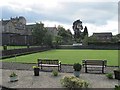
Airthrey Spa Bowling Club
During their 150th anniversary year.
Image: © Richard Webb
Taken: 14 May 2011
0.15 miles
4
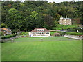
Airthrey Spa Bowling Club, Bridge of Allan
Image: © Euan Nelson
Taken: 11 Oct 2015
0.16 miles

6
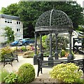
Ornamental gazebo, Provost's Park
Provost's Park, on the site of the former Trinity Church was opened in 2014. The ornamental gazebo is the centre piece. The building behind houses the public toilets.
Image: © Richard Sutcliffe
Taken: 2 Jun 2022
0.17 miles
7

Ornamental gazebo, Provost's Park
Provost's Park, on the site of the former Trinity Church was opened in 2014. The ornamental gazebo is the centre piece.
Image: © Richard Sutcliffe
Taken: 2 Jun 2022
0.17 miles
8
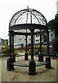
Ornamental gazebo, Provost's Park
Provost's Park, on the site of the former Trinity Church was opened in 2014. The ornamental gazebo is the centre piece.
Image: © Richard Sutcliffe
Taken: 2 Jun 2022
0.17 miles
9
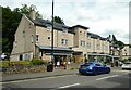
Friend Of Mine
Cafe on Henderson Street.
Image: © Richard Sutcliffe
Taken: 2 Jun 2022
0.17 miles
10
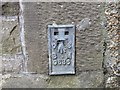
Ordnance Survey Flush Bracket G636
This bracket can be found on a retaining wall in Henderson Street, Bridge of Allan. The benchmark height is recorded as being 12.476 metres above sea level. For more detail see : http://www.bench-marks.org.uk/bm17852
Image: © Peter Wood
Taken: 4 Oct 2017
0.17 miles