IMAGES TAKEN NEAR TO
Allan Walk, STIRLING, FK9 4PD
Introduction
This page details the photographs taken nearby to Allan Walk, FK9 4PD by members of the Geograph project.
The Geograph project started in 2005 with the aim of publishing, organising and preserving representative images for every square kilometre of Great Britain, Ireland and the Isle of Man.

There are currently over 7.5m images from over14,400 individuals and you can help contribute to the project by visiting https://www.geograph.org.uk
Image Map
Images are licensed for reuse under creativecommons.org/licenses/by-sa/2.0
Notes
- Clicking on the map will re-center to the selected point.
- The higher the marker number, the further away the image location is from the centre of the postcode.
Image Listing (45 Images Found)
Images are licensed for reuse under creativecommons.org/licenses/by-sa/2.0
Image
Details
Distance
1
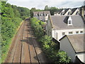
Bridge of Allan railway station (site), Stirling, 2014
Opened in 1848 by the Scottish Central Railway on the line from Stirling to Perth, this station closed in 1965. The platforms have been demolished but the building still survives as a private residence.
View north towards Dunblane and Perth. A new station has been opened some 50m behind the camera position - see Image and Image
Just over 4 years after this image was taken, the railway line was electrified.
Image: © Nigel Thompson
Taken: 9 Aug 2014
0.10 miles
2
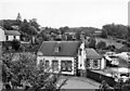
Bridge of Allan Station
View NW (approx.), towards Perth etc.; ex-Caledonian Glasgow - Stirling - Perth main line. (The station is still open - and I apologise for this poor picture: the line is just about visible behind the prominent house, which may or may not have belonged to the Station).
Image: © Ben Brooksbank
Taken: 25 Sep 1974
0.12 miles
3
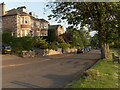
Blairforkie Drive, Bridge of Allan
Housing typical of the town.
Image: © Andrew Smith
Taken: 14 Jun 2006
0.12 miles
4
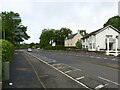
The west section of Henderson Street, Bridge of Allan
Between the bridges over the Allan Water and the railway, this was a new section of road built in the middle of the 20th century.
Image: © Alan Murray-Rust
Taken: 25 May 2022
0.12 miles
5
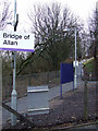
Bridge of Allan railway station
The path from the northbound platform (Platform 2) to Henderson Street.
Image: © Thomas Nugent
Taken: 2 Jan 2013
0.13 miles
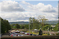
7
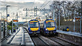
Two class 170s crossing at Bridge of Allan Station
Image: © Peter Moore
Taken: 21 Nov 2018
0.14 miles
8
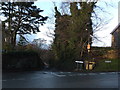
Junction of Ferniebank Brae, Glen Road and Sunnylaw Road, Bridge of Allan
Image: © Alpin Stewart
Taken: 1 Jan 2014
0.14 miles
9
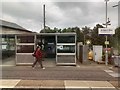
All masked up
At Bridge of Allan railway station.
Image: © Andrew Abbott
Taken: 18 Aug 2020
0.14 miles