
IMAGES TAKEN NEAR TO
Inverallan Road, STIRLING, FK9 4JD
Introduction
This page details the photographs taken nearby to Inverallan Road, FK9 4JD by members of the Geograph project.
The Geograph project started in 2005 with the aim of publishing, organising and preserving representative images for every square kilometre of Great Britain, Ireland and the Isle of Man.

There are currently over 7.5m images from over14,400 individuals and you can help contribute to the project by visiting https://www.geograph.org.uk
Image Map
Images are licensed for reuse under creativecommons.org/licenses/by-sa/2.0
Notes
- Clicking on the map will re-center to the selected point.
- The higher the marker number, the further away the image location is from the centre of the postcode.
Image Listing (86 Images Found)
Images are licensed for reuse under creativecommons.org/licenses/by-sa/2.0
Image
Details
Distance
1
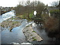
Allan Water
Weir, sluice and mill lade leading from Allan Water.
Image: © Jim Smillie
Taken: 25 Mar 2009
0.07 miles
2
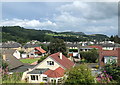
Bridge of Allan
Looking across the rooftops of a residential area on the approach to Bridge of Allan railway station.
Image: © David Robinson
Taken: 24 Jul 2019
0.08 miles
3

Allan Water
Looking downstream from the Bridge of Allan.
Image: © Richard Sutcliffe
Taken: 2 Jun 2022
0.09 miles
4
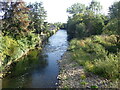
Allan Water
Flowing south to join the River Forth just north of Stirling
Image: © Eirian Evans
Taken: 7 Sep 2021
0.09 miles
5
![Bridge of Allan, Allan Water [4]](https://s2.geograph.org.uk/geophotos/02/51/36/2513614_2c372729_120x120.jpg)
Bridge of Allan, Allan Water [4]
A downstream view taking in the southern or west bank sluice gate which controls a flow of water along a lade to a large factory. Whether they use the water in the manufacturing process is another matter.
Image: © Robert Murray
Taken: 19 Jul 2011
0.11 miles
6
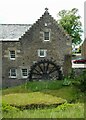
The Old Mill, Inverallan
Dating from 1710 the old grain mill was fully restored to working order in 1969, but the machinery was removed in 1979. It is Category B listed http://portal.historicenvironment.scot/designation/LB22698.
Image: © Richard Sutcliffe
Taken: 2 Jun 2022
0.11 miles
7
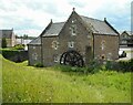
The Old Mill, Inverallan
Dating from 1710 the old grain mill was fully restored to working order in 1969, but the machinery was removed in 1979. It is Category B listed http://portal.historicenvironment.scot/designation/LB22698.
Image: © Richard Sutcliffe
Taken: 2 Jun 2022
0.11 miles
8
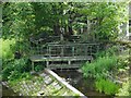
Sluice mechanism
On the lade from the Allan Water. The sluice was used to control the flow of water to Keirfield, a former bleaching and dyeing mill just to the south.
Image: © Richard Sutcliffe
Taken: 2 Jun 2022
0.11 miles
9
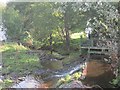
Weir, Bridge of Allan
A lade leaves here, serving what was Kierfield Mill (marked as a bleaching mill on 19th century maps).
Image: © Richard Webb
Taken: 28 Sep 2012
0.11 miles
10
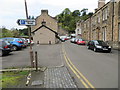
Allanvale Road in Bridge of Allan
Looking northward.
Image: © Peter Wood
Taken: 4 Oct 2017
0.11 miles