
IMAGES TAKEN NEAR TO
Henderson Street, STIRLING, FK9 4HF
Introduction
This page details the photographs taken nearby to Henderson Street, FK9 4HF by members of the Geograph project.
The Geograph project started in 2005 with the aim of publishing, organising and preserving representative images for every square kilometre of Great Britain, Ireland and the Isle of Man.

There are currently over 7.5m images from over14,400 individuals and you can help contribute to the project by visiting https://www.geograph.org.uk
Image Map
Images are licensed for reuse under creativecommons.org/licenses/by-sa/2.0
Notes
- Clicking on the map will re-center to the selected point.
- The higher the marker number, the further away the image location is from the centre of the postcode.
Image Listing (35 Images Found)
Images are licensed for reuse under creativecommons.org/licenses/by-sa/2.0
Image
Details
Distance
1
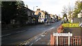
Bridge of Allan
Looking along Henderson Street, the long main street of Bridge of Allan. It is also the A9.
Image: © Richard Webb
Taken: 26 Oct 2008
0.02 miles
2
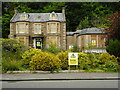
Danger - unsafe building
103 Henderson Street is a Category C listed http://portal.historicenvironment.scot/designation/LB22631 former hotel. It has been vacant for several years and is boarded up. Plans were lodged in 2021 for the building and the adjacent property at 105 Henderson Street to be partly demolished and replaced by a 70 room care home.
Image: © Richard Sutcliffe
Taken: 2 Jun 2022
0.06 miles
3
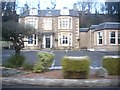
Royal Lodge, Bridge of Allan
On Henderson Street (A9).
Image: © Stanley Howe
Taken: 12 Dec 2012
0.06 miles
4
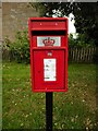
Postbox, Forglen Road
A pedestal postbox, which replaced a George V wall box mounted in a brick pillar, sometime between 2014 and 2016. It is postbox number FK9 201.
Image: © Richard Sutcliffe
Taken: 2 Jun 2022
0.09 miles
5
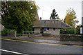
Police Station on Perth Road, Bridge of Allan
Image: © Ian S
Taken: 22 Oct 2014
0.12 miles
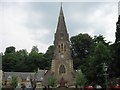
7
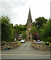
Former Chalmers Church
Category B listed http://portal.historicenvironment.scot/designation/LB22626 former church, dating from 1856. It closed in 2003 and was subsequently divided into five dwelling houses.
Image: © Richard Sutcliffe
Taken: 2 Jun 2022
0.17 miles
8
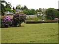
Pullar Memorial Park
Looking towards the war memorial, unveiled in 1923 in what was then a field, but which has subsequently been landscaped as a park, named after the donor of the ground, Mr Edmund Pullar of Westerton.
Image: © Richard Sutcliffe
Taken: 2 Jun 2022
0.17 miles
9
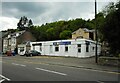
Physiofocus
A physiotherapy and sports injury clinic on Henderson Street.
Image: © Richard Sutcliffe
Taken: 2 Jun 2022
0.18 miles
10
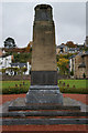
War Memorial at Pullar Park, Bridge of Allan
Image: © Ian S
Taken: 22 Oct 2014
0.18 miles