
IMAGES TAKEN NEAR TO
Manse Road, STIRLING, FK8 3XF
Introduction
This page details the photographs taken nearby to Manse Road, FK8 3XF by members of the Geograph project.
The Geograph project started in 2005 with the aim of publishing, organising and preserving representative images for every square kilometre of Great Britain, Ireland and the Isle of Man.

There are currently over 7.5m images from over14,400 individuals and you can help contribute to the project by visiting https://www.geograph.org.uk
Image Map
Images are licensed for reuse under creativecommons.org/licenses/by-sa/2.0
Notes
- Clicking on the map will re-center to the selected point.
- The higher the marker number, the further away the image location is from the centre of the postcode.
Image Listing (11 Images Found)
Images are licensed for reuse under creativecommons.org/licenses/by-sa/2.0
Image
Details
Distance
1
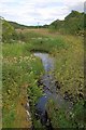
The Pow
The name of the small burn draining the marshlands south of Kirkton.
Image: © Mick Garratt
Taken: 22 Jul 2011
0.08 miles
2
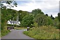
Minor road to Aberfoyle
The bridge over the Bofrishlie Burn, a tributary of the River Forth.
Image: © Jim Barton
Taken: 1 Sep 2015
0.08 miles
3
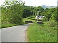
Towards Kirkton
Good track heading back towards Aberfoyle takes you across this bridge, just before Kirkton. The burn coming down from Loch Ard Forest appears to be diverted over the flood plain in a man made straight line, to join up with River Forth.
Image: © Derek Ferris
Taken: 8 Jun 2007
0.09 miles
4
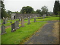
Aberfoyle: Old Parish Church
Built in 1744 superseded by present parish church in 1870.
Image: © Jim Smillie
Taken: 31 Jul 2010
0.11 miles
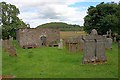
6
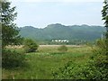
East of Kirkton
Looking N/E from bend just before the bridge.
Eastern end of Aberfoyle can be seen in centre right, behind line of trees.
The modified line of the burn can just be picked out, running diagonally across, behind the near bushes.
Image: © Derek Ferris
Taken: 8 Jun 2007
0.12 miles
7
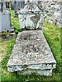
Reverend Robert Kirk - The Fairy Minister
Robert Kirk was minister at Kirkton Church, Aberfoyle between 1685 and 1692. He was known as the Fairy Minister because of his interest in fairies. In 1691 he wrote a book called, The Secret Commonwealth, about the lives of elves, fauns and fairies. Just one year later, he passed away while walking on Doon Hill.
His grave was marked by a stone with the inscription, Robertus Kirk, A.M., Linguæ Hiberniæ Lumen. Popular legend questions whether his ashes or even his body is buried there. After his death, folktales arose saying that his body had been taken away by fairies to become the Chaplain to the Fairy Queen.
Robert Kirk (folklorist) https://en.wikipedia.org/wiki/Robert_Kirk_(folklorist)
The Minister's Pine - Doon Hill, Aberfoyle https://www.geograph.org.uk/photo/6892888
Image: © Raibeart MacAoidh
Taken: 2 Jul 2021
0.13 miles
8
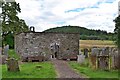
Aberfoyle Old Kirk
Either side of the entrance are two 'mort safes', iron coffins in which bodies were stored as a precaution against body-snatching before burial.
Image: © Jim Barton
Taken: 1 Sep 2015
0.13 miles
9
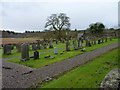
Kirkton cemetery
Old burial ground and kirk of Aberfoyle.
Image: © James Allan
Taken: 14 Nov 2015
0.14 miles
10
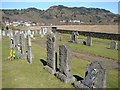
Aberfoyle Cemetery
Cemetery at Aberfoyle (Kirkton) with the village in the distance.
Image: © Chris Newman
Taken: 4 Apr 2007
0.20 miles