
IMAGES TAKEN NEAR TO
Fintry Road, STIRLING, FK8 3HL
Introduction
This page details the photographs taken nearby to Fintry Road, FK8 3HL by members of the Geograph project.
The Geograph project started in 2005 with the aim of publishing, organising and preserving representative images for every square kilometre of Great Britain, Ireland and the Isle of Man.

There are currently over 7.5m images from over14,400 individuals and you can help contribute to the project by visiting https://www.geograph.org.uk
Image Map
Images are licensed for reuse under creativecommons.org/licenses/by-sa/2.0
Notes
- Clicking on the map will re-center to the selected point.
- The higher the marker number, the further away the image location is from the centre of the postcode.
Image Listing (7 Images Found)
Images are licensed for reuse under creativecommons.org/licenses/by-sa/2.0
Image
Details
Distance
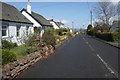
2
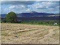
Field on the edge of Kippen
Recently harvested field and a view over Flanders Moss to Ben Ledi.
Image: © Richard Webb
Taken: 18 Sep 2015
0.15 miles
3

Hills of Menteith from Kippen
Northward view over Tay Valley to Lake of Menteith (barely visible), the Hills of Menteith and on the horizon Ben Ledi (2,845 ft.).
Image: © Ben Brooksbank
Taken: 6 Jul 1986
0.18 miles
4
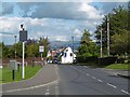
Castlehill, Kippen
The road into Kippen from Fintry.
Image: © Richard Webb
Taken: 18 Sep 2015
0.21 miles
5
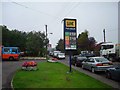
Sunday morning, Kippen
The Southwest end of the village. The lorry , right is delivering tarmac to the drive of a new house. Rural fuel prices have dropped away from the £1 a litre of a few weeks earlier.
Image: © Richard Webb
Taken: 17 Sep 2006
0.25 miles
7
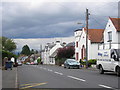
The main street in Kippen
The view of the B822 Lennoxtown to Callander road, the main road in Kippen.
Image: © Sandy Gemmill
Taken: 17 Jul 2009
0.25 miles