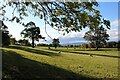
IMAGES TAKEN NEAR TO
Kippen, STIRLING, FK8 3EY
Introduction
This page details the photographs taken nearby to FK8 3EY by members of the Geograph project.
The Geograph project started in 2005 with the aim of publishing, organising and preserving representative images for every square kilometre of Great Britain, Ireland and the Isle of Man.

There are currently over 7.5m images from over14,400 individuals and you can help contribute to the project by visiting https://www.geograph.org.uk
Image Map
Images are licensed for reuse under creativecommons.org/licenses/by-sa/2.0
Notes
- Clicking on the map will re-center to the selected point.
- The higher the marker number, the further away the image location is from the centre of the postcode.
Image Listing (7 Images Found)
Images are licensed for reuse under creativecommons.org/licenses/by-sa/2.0
Image
Details
Distance
1
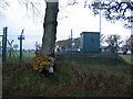
Arnprior Service Reservoir near Thorntree Farm
Image: © Dumgoyach
Taken: 13 Nov 2006
0.07 miles
2

Pasture, Townhead
Grassland above Arnprior. View towards Ben Lomond.
Image: © Richard Webb
Taken: 11 Jun 2009
0.12 miles
3

Sheep grazing, Townhead
Grassland above Arnprior.
Image: © Richard Webb
Taken: 11 Jun 2009
0.13 miles
4
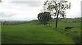
Arable land above Arnprior
Crops growing in a field which slopes down towards the Arnprior Glen.
Image: © Richard Webb
Taken: 11 Jun 2009
0.14 miles
5
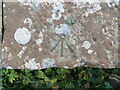
Ordnance Survey Cut Mark with Rivet
This mark and rivet con be found on top of parapet of a road bridge near Thorntree, Arnprior.
The recorded details give a height of 133.2921 metres above sea level.
For more detail see : https://www.bench-marks.org.uk/bm179746
Image: © Peter Wood
Taken: 4 Sep 2022
0.20 miles
6
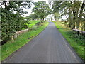
Minor road between Thorntree and Lintmiln
Looking southward. The bridge in the foreground spans an un-named burn.
Image: © Peter Wood
Taken: 4 Sep 2022
0.23 miles